Mt. Lawlor Firebreak

TRs for the San Gabriel Mountains.
Post Reply
User avatar
Uncle Rico
Posts: 1394
Joined: Thu Mar 20, 2008 7:48 pm

Post by Uncle Rico »

Finally got back into the San Gabes yesterday after a long hiatus. Driving burn out kept me away for a spell. Decided I make my way to the summit of Lawlor where I knew no one would be. The forest was a madhouse. Big T was clogged with cars at the Trail Canyon trailhead (See TR by David R for detes). Clear Creek was a zoo. Switzer was shit show. And the parking lot at Red Box was stuffed full. I scored the last spot adjacent to the privy and started up.

It was a perfect day with a slight breeze and temps in the low 70s. A thick fog bank sat over the basin. Back in the olden days when we walked to and from school in the snow with no shoes and it was up hill both ways, I could hike the Strawberry Peak trail and maybe run into a handful of folks the entire day. But Strawberry has been hyped on social media so the trail now is like the LA freeways. As I went, I counted the folks I encountered. By the time I reached the firebreak for Lawlor, I'd run into 28 hikers.

Being the misanthrope that I am, I decided to get out of the annoying conga line and head up the firebreak instead of going the traditional route. I figured few if any would make that same decision and I was right. No one followed and I had the firebreak to myself - for whatever that's worth.
20220410_114723.jpg
20220410_122338.jpg
20220410_114821.jpg

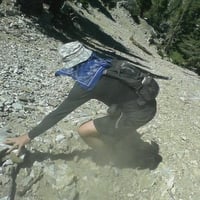
As you y'all know, the firebreak is a short but challenging route. Very steep and loose and exposed. The guy operating the dozer that cut this break must have balls of titanium. Thre break affords really nice looks into the West Fork and over toward Wilson which distracts from the climb. I picked through the loose screw, cables, old railroad ties, etc. that had been dredged up when they cut the break and in no time popped up onto Lawlor's summit. There was a small rock pile there, but no register and it really wasn't very inviting. Thus, the absence of crowds. So I worked my way down the firebreaks as it tracks toward Barley Flats to a big rock outcropping on the left. Big view from here. I hung out here for a bit just taking it in and enjoying being there.
20220410_124013.jpg
20220410_124020.jpg

After sitting a spell, I headed back by the traditional route. The firebreak was ok for ascending, but descending seemed like it could get a bit sketchy. The use trail was easy to follow as it has seen more traffic with the forest's exploding popularity. The Strawberry Peak trail was in great shape. Big props to the folks who originally cut and now maintain it.

Overall a good day in the Gabes.
20220410_130141.jpg
20220410_141223.jpg
20220410_122330.jpg
User avatar
Uncle Rico
Posts: 1394
Joined: Thu Mar 20, 2008 7:48 pm

Post by Uncle Rico »

Hmm. That last pic is totally out or order. I have no idea. Pretend it is no. 2 in the series.
User avatar
HikeUp
Posts: 3847
Joined: Thu Sep 27, 2007 9:21 pm

Post by HikeUp »

Thanks for the report.

If you like steep, try descending the south side of Lawlor. A scree ski through a gauntlet of Yucca - have fun! ;)
User avatar
dima
Posts: 1319
Joined: Wed Feb 12, 2014 1:35 am

Post by dima »

Is this the W side of Lawlor, from the Strawberry-Lawlor saddle? The South side is more exciting, as HikeUp says. I climbed Strawberry yesterday, and we hiked the loop around the North side. There're a bunch of people hiking Strawberry. I expected it to be even worse, so it was a pleasant surprise. And it's weird. I think the only reason to summit Strawberry is to scramble up the West ridge, so all the people coming up from the other side are doing it wrong.
User avatar
HikeUp
Posts: 3847
Joined: Thu Sep 27, 2007 9:21 pm

Post by HikeUp »

Oh shit...I misread I think. He did go up then down the south side. doh
User avatar
dima
Posts: 1319
Joined: Wed Feb 12, 2014 1:35 am

Post by dima »

That's what I thought he did when I read the report, but you made me doubt my reading comprehension skills. Rico: we need things to be spelled out in way more detail, apparently :)
User avatar
HikeUp
Posts: 3847
Joined: Thu Sep 27, 2007 9:21 pm

Post by HikeUp »

Yeah Rico, I blame you for my lack of reading comprehension.

Use crayons next time.
User avatar
Uncle Rico
Posts: 1394
Joined: Thu Mar 20, 2008 7:48 pm

Post by Uncle Rico »

Y'all got me questioning my own TR.

I went up the firebreak on the south side and descended the standard route on the west ridge.
User avatar
HikeUp
Posts: 3847
Joined: Thu Sep 27, 2007 9:21 pm

Post by HikeUp »

Now that I've gotten up to speed...here is a pick looking up the south side (June 2008). No firebreak, just fucca plants and steapness.
IMG_1060.jpg
Screenshot 2022-04-11 at 17-33-09 Google Earth.png

And the view looking down (June 2008)...

IMG_1131.jpg
User avatar
Sean
Posts: 3749
Joined: Wed Jul 27, 2011 12:32 pm

Post by Sean »

So that answers the question of whether they restored the firebreak between Lawlor and Barley Flats. That route is wide open now. Thanks for the report!
Post Reply