Turtle's Beak via Cascade Canyon

TRs for the San Gabriel Mountains.
Post Reply
User avatar
Sean
Posts: 3748
Joined: Wed Jul 27, 2011 12:32 pm

Post by Sean »

Turtle's Beak (formerly Peak 6857) is a rather spectacular schnoz along the SW ridge of Ontario Peak.

Image
(The Beak, on the right, seen from Sunset Peak)

We have Turtle and Hiking Jim to thank for giving this peak a worthy and memorable name. Turtle's TR from Oct. 2013 stuck in my mind all this time, but I never got around to visiting the Beak until last weekend.

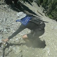
I convinced my girlfriend, Cecelia, to join me, and early Sunday morning we were walking up the Barrett-Stoddard road toward Cascade Canyon.

Image

The entrance to Cascade is 1.6 miles up the road. From this point it's only another 1.2 miles to the Beak. However, the obstacles and scenery will surely slow you down to a crawl--literally in some sections.

Image

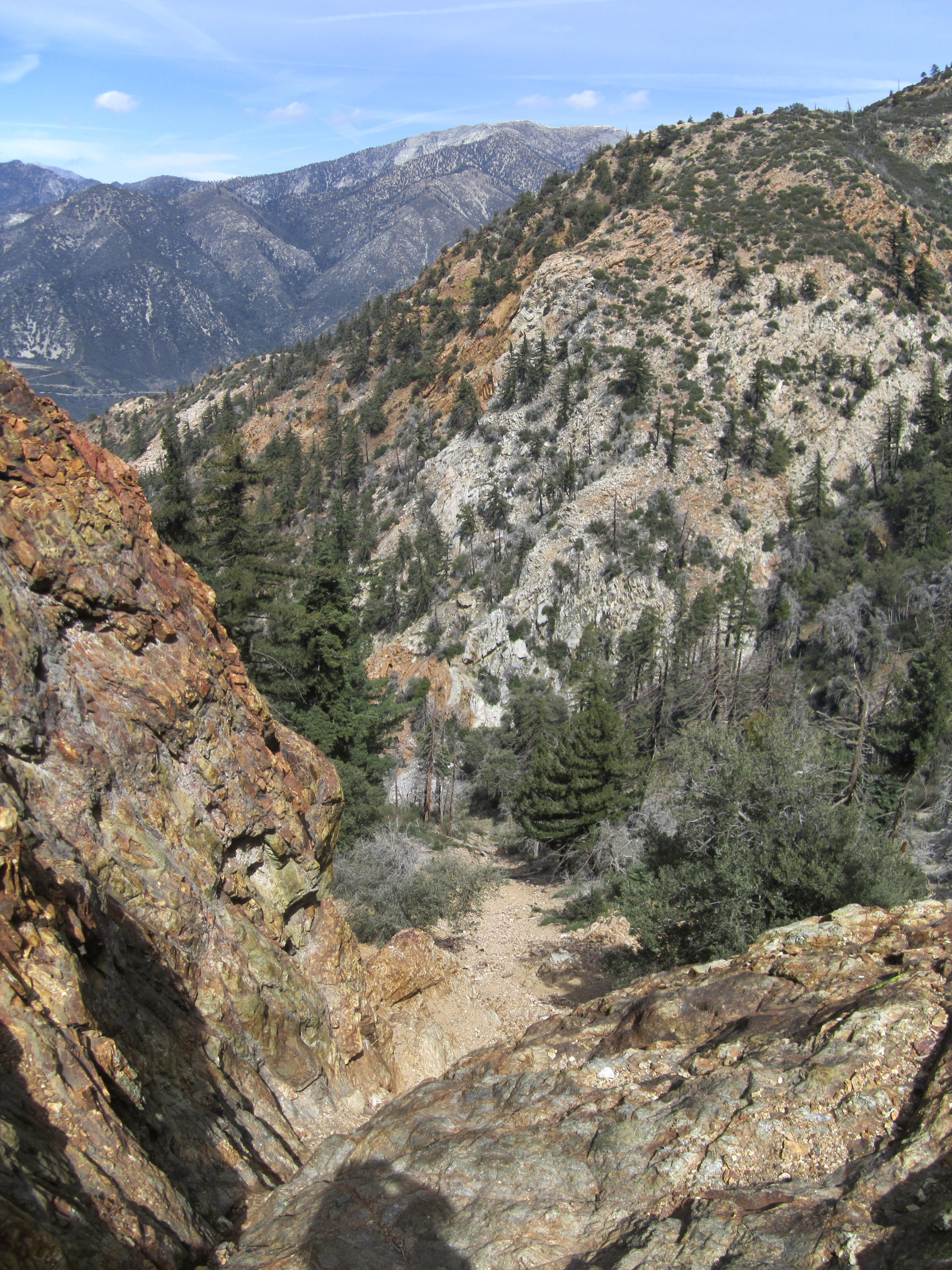
If you're into red rock formations, this is the place for you.

Image

And who doesn't enjoy a canyon with an overwhelming supply of climbing opportunities?

Image

The main challenge tops out at difficult class 3 with bad exposure, but more difficult side-excursions abound.

Image

Around the 5800' mark, above a class 3 fall, the canyon splits, and there is a rather colorful rock marking the point of departure for the summit push.

Image

Turning right, with our back to the colorful rock, we started straight up the slope, in the general direction of the Beak. From this point there is another 1000 feet of climbing.

It begins like most steep, slope climbs in the area.

Image

But then the awesome view factor increases exponentially.

Image

And hopefully you'll find the equally awesome climbing route through the rocky north side of the Beak.

Image

Image

Image

After some of the most rewarding climbing in the Baldy area, we were finally at the final approach.

Image

In a few more minutes we finally stood on the Beak itself.

Image

This amazing mountaintop has few rivals for most beautiful in the San Gabriel Mountains.

Image

Image
(Cecelia on the true summit)

I think I enjoyed the peak itself more than the panoramic views.

Image

And that should tell you something.
User avatar
Uncle Rico
Posts: 1394
Joined: Thu Mar 20, 2008 7:48 pm

Post by Uncle Rico »

Your TR is more bad-ass than mine. 8)
User avatar
Taco
Posts: 6001
Joined: Thu Sep 27, 2007 4:35 pm

Post by Taco »

That place looks rad.
User avatar
tkane
Posts: 12
Joined: Mon Sep 02, 2013 1:11 pm

Post by tkane »

Awesome trip, Cascade is one of the best.
User avatar
turtle
Posts: 152
Joined: Wed Jan 27, 2010 11:35 am

Post by turtle »

Now this here is a proper trip report! :wink:
User avatar
tekewin
Posts: 1194
Joined: Thu Apr 11, 2013 5:07 pm

Post by tekewin »

Rico and I made an attempt on the beak yesterday. It didn't go well. The start of Cascade Canyon was mostly clear and there was a use trail of sorts, though we missed part of it on the way up. Pretty good water flow. There was a lot of debris in the canyon and walls of blackberry thorns. At about 4600', with nothing by blackberry thorns as far as we could see, we went right up a steep dirt slope, but ended at a cliff on a side canyon. We could see the class 3 waterfall bypass since someone left a hand rope there. We continued up on rocks until they were overtaken with buckthorn. We returned to the canyon to see if we missed an obvious way past the solid blackberry but didn't find one. Finally, we backed off and had some food on Stoddard. Maybe Cascade was always this overgrown, but it was worse than I expected. This was near the cliff out point..
User avatar
Sean
Posts: 3748
Joined: Wed Jul 27, 2011 12:32 pm

Post by Sean »

Well that's a bummer. Cascade is rough. You might need a tool to get through the vegetation at a couple points.
User avatar
Uncle Rico
Posts: 1394
Joined: Thu Mar 20, 2008 7:48 pm

Post by Uncle Rico »

Sean wrote: Cascade is rough. You might need a tool to get through the vegetation at a couple points.
The drainage is a continuous tangle of deadfall, poison oak, brambles, and loose rocks. But scarlet monkey-flower was blooming everywhere which was kinda cool. Unless we failed at navigation, the only way through is to eventually bash through an unrelenting wall of blackberry.

We did get Stoddard as a participation trophy so all was not lost.

This is basically what entire canyon looks like. Definitely a hard slog.
10_Cascade Cyn.jpg
User avatar
Sean
Posts: 3748
Joined: Wed Jul 27, 2011 12:32 pm

Post by Sean »

Maybe you guys went left when you should have gone right? There is a split where you go right to the Beak and left to the old mine site.
User avatar
Uncle Rico
Posts: 1394
Joined: Thu Mar 20, 2008 7:48 pm

Post by Uncle Rico »

No, we saw that subsidiary drainage coming in from the left, but stayed to the right. We took a second look at it on the way down and concluded it could not possibly be the correct route. It looked less inviting than the main drainage.
User avatar
Sean
Posts: 3748
Joined: Wed Jul 27, 2011 12:32 pm

Post by Sean »

My guess is that the big winter storms contributed to even more vegetation clogging the canyon this year. I remember a lot of ants too.
User avatar
dima
Posts: 1319
Joined: Wed Feb 12, 2014 1:35 am

Post by dima »

Yeah, the last few years probably didn't make the travel down there any easier. My recollection from a few years back is that the canyon was medium-clogged, but still passable.
User avatar
tekewin
Posts: 1194
Joined: Thu Apr 11, 2013 5:07 pm

Post by tekewin »

I expected the canyon to be more pleasant than the ridge down from Ontario, based on descriptions from both Sean and Dima. That situation might be reversed for now...maybe.
User avatar
Sean
Posts: 3748
Joined: Wed Jul 27, 2011 12:32 pm

Post by Sean »

Well, if you try Ontario to the Beak prepare for the worst wall of thorns you may have ever seen. I believe Turtle avoided some of it by switching ridges.
User avatar
Sean
Posts: 3748
Joined: Wed Jul 27, 2011 12:32 pm

Post by Sean »

Justin just tried this route and didn't make it either. But if anyone can reblaze the route, it'll be him.
User avatar
David R
Posts: 527
Joined: Sun Jun 12, 2011 10:28 pm

Post by David R »

His second ascent was successful and he made it via Ontario and came down Cascade Canyon.
Post Reply