Fall Creek fire road bike ride

TRs for the San Gabriel Mountains.
Post Reply
User avatar
dima
Posts: 1320
Joined: Wed Feb 12, 2014 1:35 am

Post by dima »

Last weekend Kris and I went biking in the mountains. The plan was a chill 2-day ~100-mile loop. Ended up being less chill than expected, but still nice.

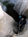
We met near the bottom of hwy 2, rode up to Clear Creek, down Angeles Forest hwy a bit, down Big T a bit to the start of the abandoned fire road over there. We then dropped down to Big Tujunga. This section is abandoned, and exists as a rough single-track. Surprising numbers of people even here. One group was canyoneering, with the rest just walking around. We got water at the river.

Image

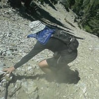
After a break, we climbed out only to realize that it was now kinda warm, and we didn't have nearly enough water to keep going. So we took a nap under a bush, then went back down to the river, got way more water, and were now good to go. Fall Creek is dry. Fox Creek is still flowing allegedly. The climb up is still a rough single-track, although somebody clipped the bushes, and it's not a bushwhack anymore. After climbing out of the Big Tujunga canyon, this route serves as the service road for Edison's power lines, and it actually receives maintenance and is an actual dirt road. Up until ~ 4000ft this is quite sandy. Above that it firms up, and riding it becomes much easier. At 4000ft the road climbs to a saddle between Fall and Fox creeks, and there's a water tank here which was the camp spot for the night. Only about 37 miles for me this day. Felt like a lot more somehow.

Image

In the morning, I looked at where we were going that day, and we packed up and set off.

Image

I was very excited to find the "Wreck" benchmark. It is gone. But instead we have some sort of measurement of the powerline tower leg strengths

Image

and some sort of loose SCE benchmark instead

Image

Image

I was excited about the next benchmark ("Plane"), but this one had even less to offer. Progress:

Image

Image

Eventually we crested at the Santa Clara Divide road, a bit W of Mt Gleason. The views to the desert opened up here. And looking back were clear views of PV, both sides of Catalina island, and the DTLA towers.

Image

The Station Fire memorial to the firefighters was here. And some ruins. Who has been here? Is this the camp 16 fire-fighting camp? Did it burn down in the Station Fire? Speaking of the Station Fire, there's no tree cover anywhere up to this point. The road here is paved all the way to Mill Creek summit, so this was a quick descent. We got more water, and rode up towards Pacifico mtn. This is dirt again. Pretty burnt out and exposed until the Granite/Round Top ridge, where some trees appear. At the turnoff to the peak we saw this:

Image

From what I hear, 3.2 miles later is right before the paved road junction at Alder Gulch. And that there's nothing obviously wrong with the road. This was a Sunday; there was a dozer parked on the side of the road, doing nothing. Now there were trees and we were relatively high up, so the heat wasn't as oppressive. We took the pavement East towards Islip Saddle. I stared at a suspicious-looking branch at the first tunnel for a solid minute:

Image

Dead-center of the photo. This branch just would not move, so we moved on. Allegedly a friend of a friend of a friend was ticketed riding the closed section of hwy 39, so we played it safe, and went back via Windy gap. Only 75 miles this day. Still felt tired, but this was better than the 37 of the day before.
User avatar
Elwood
Posts: 612
Joined: Fri Aug 15, 2008 5:23 pm

Post by Elwood »

Awesome post and pictures! The ‘ruins’ while last used as a county work camp are actually old Nike air defense support buildings. I hiked up there last year and took lots of pictures.
User avatar
AW~
Posts: 2038
Joined: Mon Oct 01, 2007 12:00 pm

Post by AW~ »

Nostaglic for me cause thats where my san gabriel excursions began in 2005.
Its also been a pretty epic road as far as the conditions changing.
I like this one on the internet from 2004 : "took my XR250R on Fall Canyon Rd. (3n27) from Big T Cyn. to 3n17. At the bottom of the canyon, in the overgrown mess where the stream crosses what used to be the road, I had to move some big fallen trees to get my XR across. Anyone who has been there knows what I'm talking about; there's a concrete bridge remnant over to the right of the boulder-filled stream course area, but no way to get to it, or up onto it, on the bike. Thirty minutes of huffin and heavin cleared the way. I thought about riding up Fall Creek Trail, but it looked pretty steep and narrow from my vantage point coming down into the canyon, so I stayed on the fire road. That road is not maintained and it shows. Rock slides that completely covered the road, yucca stumps, runoff ravines that wanted a piece of my tires. I think I hit 4th gear once. The frigid wind was my only companion. At about mile 7, the road condition improved, at mile 10 I started seeing snow on the road, and when I reached the junction of 3n17, I was in a full-on snowstorm! Everything was white, and my tracks were the only ones there. I had wanted to take 3n17 over to Magic Mtn, eat some lunch, take some pictures, but it was just too cold. I grew up in Maine, so I'm no stranger to cold weather, but I moved to SoCal to get away from it, so back down the fire road I went. The creek crossing was easier the second time around, and I passed a black Jeep on the road about halfway between the bottom and Big T. Cyn Rd. And the gate at the top was locked. Go figure. I'll try this road again in the spring; I worked too hard on those trees to just do the ride one time!"
User avatar
dima
Posts: 1320
Joined: Wed Feb 12, 2014 1:35 am

Post by dima »

Hah. Yeah. You can't do that anymore. That section (down, across Big T and back up) is better than it was, but my standards have been reduced
User avatar
davidwiese
Posts: 88
Joined: Mon Jul 30, 2018 4:00 pm

Post by davidwiese »

dima wrote: The Station Fire memorial to the firefighters was here. And some ruins. Who has been here? Is this the camp 16 fire-fighting camp? Did it burn down in the Station Fire?
My wife and I hiked through there on our Mendenhall Ridge Traverse (overnight trip from Mill Creek to Pacoima). It is indeed Camp 16 and it burned in the Station Fire. Very eerie place up there, just east of Gleason.

We hiked on the PCT from there on the North side of Gleason, then went up the NW ridge to the summit for a really nice lunch break. A few months ago, it was super green and beautiful. One of my favorite peaks in the San Gabes for sure. Does anyone know if they ever open the gate at Mill Creek to drive up there? You can find trip reports from some years ago where people report driving up pretty close to Gleason. Now, it seems like you have ~11 miles of hiking or biking minimum to get there.
IMG_20200502_153415.jpg
IMG_20200502_153051.jpg
IMG_20200502_150207.jpg
User avatar
dima
Posts: 1320
Joined: Wed Feb 12, 2014 1:35 am

Post by dima »

I have no idea if that gate is ever opened, but you should just ride there. It's relatively close, and it's not a big climb AND most (all?) of it is paved even.
User avatar
HikeUp
Posts: 3847
Joined: Thu Sep 27, 2007 9:21 pm

Post by HikeUp »

dima wrote:I have no idea if that gate is ever opened, but you should just ride there. It's relatively close, and it's not a big climb AND most (all?) of it is paved even.
Back in January 2009, months before the station fire, the gate was open. I was able to get 7.5 miles up the road before a bunch of ice and snow blocked my way. It appeared that 4-wheel drive + chains had been used to get across this patch by others. Made short work of bagging Gleason!

Sorry, but no idea of more info on current gate openings.

@davidwiese Did you happen to see the cowbell on the summit?
User avatar
davidwiese
Posts: 88
Joined: Mon Jul 30, 2018 4:00 pm

Post by davidwiese »

HikeUp wrote:
dima wrote:I have no idea if that gate is ever opened, but you should just ride there. It's relatively close, and it's not a big climb AND most (all?) of it is paved even.
Back in January 2009, months before the station fire, the gate was open. I was able to get 7.5 miles up the road before a bunch of ice and snow blocked my way. It appeared that 4-wheel drive + chains had been used to get across this patch by others. Made short work of bagging Gleason!

Sorry, but no idea of more info on current gate openings.

@davidwiese Did you happen to see the cowbell on the summit?
These are my shots from the summit plateau... no cowbell :(
IMG_20200502_154340.jpg
IMG_20200502_154224.jpg
IMG_20200502_154227.jpg
IMG_20200502_153956.jpg
IMG_20200502_154232.jpg
IMG_20200502_154135.jpg
User avatar
Tom Kenney
Posts: 362
Joined: Sat Sep 29, 2007 7:51 pm

Post by Tom Kenney »

The Santa Clara Divide Road used to be open all the way from Three Points until almost CA-14. There is an old gate just west of Sombrero that was the 'terminus' for public vehicle travel. The Pacifico section saw occasional all-year closures due to damage, but they tried to keep it open if possible...gave up on that. Then the section from Bear Divide to Mill Creek Summit was closed (after the fire, IIRC). I think it may have been open once since then, but has been closed for many years now. West of Bear Divide it's open 6A-6P.
User avatar
dima
Posts: 1320
Joined: Wed Feb 12, 2014 1:35 am

Post by dima »

Just looked at the map. Where would you be going West of Bear Divide?
User avatar
Tom Kenney
Posts: 362
Joined: Sat Sep 29, 2007 7:51 pm

Post by Tom Kenney »

Los Pinetos Trail starts at Wilson Canyon Saddle. There's a full-blown trailhead with bathroom, tables, signage. Also Viper Tr nearby, Sombrero is a good ride/hike. When temps are cooler, I'll ride from my house over to Sylmar, up May Canyon Rd, down Santa Clara to CA-14, then back over Newhall Pass. Makes about a 30+ mi loop with a few k ft of climbing.
User avatar
HikeUp
Posts: 3847
Joined: Thu Sep 27, 2007 9:21 pm

Post by HikeUp »

Cowbell (Jan. 2009)
IMG_2726.jpg

IMG_2707.jpg
User avatar
Sean
Posts: 3749
Joined: Wed Jul 27, 2011 12:32 pm

Post by Sean »

Thanks for the report. Awhile back I created a video about Fire Camp 16.

User avatar
davidwiese
Posts: 88
Joined: Mon Jul 30, 2018 4:00 pm

Post by davidwiese »

Very cool video. Almost none of the walls/structures from your 2017 trip are standing anymore today. Only foundations and the small wall on the right at 2:25 in your video.

This is the only pic I have from earlier this year that shows the general area, but if you zoom in on the right you can see all that remains. This is taken from where the memorial to the firefighters / their crosses are.
IMG_20200502_125136.jpg
User avatar
Sean
Posts: 3749
Joined: Wed Jul 27, 2011 12:32 pm

Post by Sean »

They really cleaned it up. The Google aerial still shows the ruins.

Screenshot_2020-08-08-05-09-23~2.png
Post Reply