
The hiker that I know who is friends with them mentioned that it was dark (or at least getting dark) when they were on their descent. I'm guessing it was getting dusk when they started and so it got worse soon after. It was certainly clear that they expected an actually trail, however.
I would guess it was the GPS I linked to, I don't know how many GPS of the southwest ridge could their be? Either way, its not Travis's fault, it was very clear in the description (and pictures) what that route entailed.
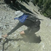
Search for hikers near Heaton Flats

Indeed. Quoth Travis, "This was one of the more difficult hikes I have ever done."JMunaretto wrote:I would guess it was the GPS I linked to, I don't know how many GPS of the southwest ridge could their be? Either way, its not Travis's fault, it was very clear in the description (and pictures) what that route entailed.
Nunc est bibendum

There is indeed a use trail going down the SW ridge of Iron for a while - I inadvertently led my group down the ridge on my first trip to Iron (which was via the Baldy to Iron traverse). I only realized we were on the wrong trail when I hit the first short section of Class 3 -- something I knew I shouldn't find. When Travis and I went up this route, snow covered much of the ridge so I don't know how far the trail descends (nor do I ever intend to find out). As stated by others, simply reading our account (and how we were lured in by an HPS report) should have warned any inexperienced person off the route. Tom
-
FIGHT ON
Tom is there any way you can put a point on a map to show exactly where that first steep part is. Like Acme Mapper? That would be cool. Thanks.bechtt wrote:There is indeed a use trail going down the SW ridge of Iron for a while - I inadvertently led my group down the ridge on my first trip to Iron (which was via the Baldy to Iron traverse). I only realized we were on the wrong trail when I hit the first short section of Class 3 -- something I knew I shouldn't find. When Travis and I went up this route, snow covered much of the ridge so I don't know how far the trail descends (nor do I ever intend to find out). As stated by others, simply reading our account (and how we were lured in by an HPS report) should have warned any inexperienced person off the route. Tom
We didn't experience any real steep portions on the ridge itself -- I'm sure they exist like they do on the regular portion (possibly lower). The toughest part of the route was attaining the ridge from above Allison Mine and even that wasn't that bad. For us, the worst part of the trip was probably the brush -- something you just can't get away from when exploring the S.Gs. Are there places to fall -- sure but that can happen anywhere in these mountains if you wander off the path
-
FIGHT ON
Tom. I am curious where the first class 3 section is that you mentioned on your previous post is " I only realized we were on the wrong trail when I hit the first short section of Class 3 ". I don't ever plan to go that way from the top but I guess I could go peek  down at this spot. Did you guys turn back and go down the east regular route at this point or did you continue down the sw ridge?
It's about 200' down from the plateau (I think it's the photo that Travis has on his web page of me hiking up the corniced ridge). We climbed partially back up and then crossed the very steep south face of Iron to get to the correct ridge. That was my first time on Iron and I didn't know what to expect (the regular steep and rollercoaster route was bad enough after doing the traverse in smoggy, hot July). The reason I mentioned the class 3 (trivial 6'-10') is that Travis, Augie and I have a hiking friend that freaks out on Class 3 (won't go near it). Since I knew this skittish friend had hiked Iron multiple times ... Q.E.D. When Travis and I did the SW ridge, we gained it well below the point of turnaround from the first time. Plus we experienced some great class 3 climbing up to the ridge. The ridge is very doable if you can stand the brush potential. You could probably even follow the old traverse trail (head north and west away from Allison Mine instead of towards it) and intersect the ridge proper much lower.
Much as I miss hiking with Travis, I don't miss all of that damn brush he used to drag my ass through
If you want real excitement on Iron, read Augie's North Ridge ascent!
Much as I miss hiking with Travis, I don't miss all of that damn brush he used to drag my ass through
If you want real excitement on Iron, read Augie's North Ridge ascent!
-
FIGHT ON
Thanks. If I ever do any of these hikes I will be sure I read my brains out on as much as their is so I know what to expect. for now I like trails.bechtt wrote:It's about 200' down from the plateau (I think it's the photo that Travis has on his web page of me hiking up the corniced ridge). We climbed partially back up and then crossed the very steep south face of Iron to get to the correct ridge. That was my first time on Iron and I didn't know what to expect (the regular steep and rollercoaster route was bad enough after doing the traverse in smoggy, hot July). The reason I mentioned the class 3 (trivial 6'-10') is that Travis, Augie and I have a hiking friend that freaks out on Class 3 (won't go near it). Since I knew this skittish friend had hiked Iron multiple times ... Q.E.D. When Travis and I did the SW ridge, we gained it well below the point of turnaround from the first time. Plus we experienced some great class 3 climbing up to the ridge. The ridge is very doable if you can stand the brush potential. You could probably even follow the old traverse trail (head north and west away from Allison Mine instead of towards it) and intersect the ridge proper much lower.
Much as I miss hiking with Travis, I don't miss all of that damn brush he used to drag my ass through
If you want real excitement on Iron, read Augie's North Ridge ascent!
Oh yes, trails are good.
On Sunday on my way down Icehouse Canyon, I ran into some cow and (apparently) her two hawt daughters. As I passed the cow demanded, "What happened to safety in numbers?" I didn't have time for a snappy answer, or to suggest that there is nothing remotely unsafe about hiking solo on one of the busiest trails in the San Gabriels on a summer weekend.
The cow.
Nunc est bibendum


-
FIGHT ON
Hikin_Jim wrote:You should have said, "I'm Simonov the Strangler. Do you have any other last words?"
That's funny that a woman would be concerned about a man walking solo. I never would have expected that. Usually it's that I see a woman solo and guys in twos or threes. And really funny that she said it so Simonov!
Sorry for the decade late bump - but just want to note that I too went down the incorrect trail the first time I summited Iron Mountain in the San Gabriels in Dec 2015. I apparently incorrectly went right and took the WSW route descending from the summit and it got steep really quick. Before I knew it, I was at a near 70% slope and the ground beneath me was literally giving way. Rocks were tumbling by me and continuing so far down. Luckily I grabbed some roots and pulled myself back up, went to the summit to realign, and then found the real SSW trail. After such long hike, it is so easy to get disoriented, especially alone. I hope all would-be Iron hikers read this and are aware to head to to the left side, not right side, when descending from the Iron summit. I could have easily tumbled what looked like thousands of feet had I not been going very slow and found roots to grab on to. The WSW descent seems like the correct SSW trail until the very last couple of seconds....and then you realize your mistake....
If this happens again, you should say, "You're right. Can I borrow one of your daughters?"simonov wrote: Oh yes, trails are good.
On Sunday on my way down Icehouse Canyon, I ran into some cow and (apparently) her two hawt daughters. As I passed the cow demanded, "What happened to safety in numbers?" I didn't have time for a snappy answer, or to suggest that there is nothing remotely unsafe about hiking solo on one of the busiest trails in the San Gabriels on a summer weekend.
The cow.