PackerGreg wrote: ↑Cougarmagic: What were you doing in a rugged yet easily-accessed canyon that is rarely frequented by people?
Everyone else: Use the restrooms provided before entering the East Fork lest you make an appearance in some sick video
And I would've gotten away with it too, if it weren't for you darned kids!
(There is no surveillance of the East Fork at the present time though - so no worries. Do say hi to the bears if you see them though!)
Yeah when CM asks if it's gonna be a full moon, ya gotta think carefully before ya answers.
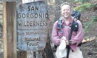
Hello everyone, I am an experienced hiker and an relatively inexperienced bushwhacker trying to reach a location in the Santa Anita Canyon East Fork.
I am very new to this forum (and forums in general) so please let me know if I'm doing anything at all wrong or unusual.
The spot circled in the map is unusually flat for a creek in the San Gabriels and rumor has it there are still some wild trout in Santa Anita Canyon. There is a possibility this spot might have some fly-fish-able pools. I researched the canyon and found this guide to reaching it relatively easily. I tried mapping out the route using an online mapping tool, and I was wondering if anyone thinks this route is doable or has pointers/objections to it, thanks.
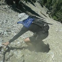
Started from Chantry Flat, following the main Santa Anita canyon channel, then turned into the East Fork. I climbed up to the Clamshell Road in your circled area. I don't remember EXACTLY what the creek looked like, but I don't think there was a ton of water. It was nice, but I'd be surprised if there was enough for fish to live there. I'd remember it more clearly if there was.
Near the main channel there were some pools, but these become a smaller river as you go upstream; I think. And I didn't take the ridge Brennen mentions. That sounds like a heavy bushwhack. You should go check it out and report back!
How were you able to pass adams falls? I read in other threads that the old trail is impassable?
1blazepatrick1 wrote:I am very new to this forum (and forums in general) so please let me know if I'm doing anything at all wrong or unusual.
Hi Patrick, welcome to the forum! Thanks for posting. We love planning hikes here and reading stories of adventures in the mountains. My only suggestion is to trim the quoted text portions in your replies. You can delete parts of the quote that aren't relevant to your comment. It makes the thread easier to scan. Just make sure to keep the bracketed BBCode tags before and after the quoted text. Then place your reply below. Let us know if you make it to that fishing spot.
Welcome! I tried the Brennen ridge about two years ago. It was fairly easy to gain the ridge, but the ridge itself was densely overgrown and not viable without protective gear, trimming tools and a lot of time.
In the east fork canyon itself, I found a section of the old trail which used to bypass the falls high on the south wall of the canyon, but after a nice section of trail along a shelf that was blasted out of solid rock, it ended in an Indiana Jones-style leap of faith across a bottomless washout. It didn't seem safe. I'd follow Dima's info for the most up-to-date reporting from the area.
If this is the first time you've tried following a route described by Brennen's online pages, here are some things to watch out for:
(a) These pages are all about 20 years old, and I don't think he actively updates them. I have often found that conditions have changed significantly by the time I get to a place he describes. E.g., I have found a canyon choked with debris so that the route he described was completely impassable.
(b) Brennen is/was a hard-man scrambler and bushwhacker. When he describes the difficulty or danger of a certain route, mentally add a calibration onto it. For me, if he says it's "straightforward," it means I'm going to be scared out of my mind. In the route you're describing, he refers to a "tough steep climb (and bushwhack)," which after calibration translates in my mind into "suicide."
(c) Brennan's sport is canyoneering, meaning he does all these trips while carrying a rope and wearing a harness, and he has a huge amount of experience with improvising rappel anchors. Although it does appear that this particular description offers a route that doesn't require rappelling, if you walk into this situation without canyoneering gear, you are limiting your options. It's very easy to get trapped in these steep canyons, because there can be slopes that you can get down but not up.
My suggestion would be that before attempting something like this route that seems likely to be hard and sketchy, you might want to get in some experience on an easy, safe canyoneering route such as Bailey Canyon. That way you have some basic canyoneering gear and skills and are less likely to get in serious trouble.
dima wrote:
It's easy to bypass on the right. Read the post.
Ok I see it now, thanks!
Hey, great topic!
I've explored the main canyon with a similar goal, but not that East Fork branch. It typically has almost no water coming out of it where it meets the main canyon, so I wrote it off.
bcrowell wrote:
(c) Brennan's sport is canyoneering, meaning he does all these trips while carrying a rope and wearing a harness, and he has a huge amount of experience with improvising rappel anchors. Although it does appear that this particular description offers a route that doesn't require rappelling, if you walk into this situation without canyoneering gear, you are limiting your options. It's very easy to get trapped in these steep canyons, because there can be slopes that you can get down but not up..
I have 200 ft of climbing rope, a harness, some climbing friends, and basic repelling experience. Thanks for letting me now about Brennan's description of difficulty (: I'm a very cautious person and I know my limits well, and I'd be hiking with like-minded friends.
With that said, I also have experience with traversing and scrambling in the San Gabriels.
bcrowell wrote:
If this is the first time you've tried following a route described by Brennen's online pages, here are some things to watch out for:
(a) These pages are all about 20 years old, and I don't think he actively updates them. I have often found that conditions have changed significantly by the time I get to a place he describes. E.g., I have found a canyon choked with debris so that the route he described was completely impassable.
(b) Brennen is/was a hard-man scrambler and bushwhacker. When he describes the difficulty or danger of a certain route, mentally add a calibration onto it. For me, if he says it's "straightforward," it means I'm going to be scared out of my mind. In the route you're describing, he refers to a "tough steep climb (and bushwhack)," which after calibration translates in my mind into "suicide."
(c) Brennan's sport is canyoneering, meaning he does all these trips while carrying a rope and wearing a harness, and he has a huge amount of experience with improvising rappel anchors. Although it does appear that this particular description offers a route that doesn't require rappelling, if you walk into this situation without canyoneering gear, you are limiting your options. It's very easy to get trapped in these steep canyons, because there can be slopes that you can get down but not up.
My suggestion would be that before attempting something like this route that seems likely to be hard and sketchy, you might want to get in some experience on an easy, safe canyoneering route such as Bailey Canyon. That way you have some basic canyoneering gear and skills and are less likely to get in serious trouble.
I read that some people have grown marijuana in this canyon. That sounds too close to a well used trail to be a secure location for that sort if activity. I dunno.
Rudy Rodriguez wrote:
I read that some people have grown marijuana in this canyon. That sounds too close to a well used trail to be a secure location for that sort if activity. I dunno.
I got all the way up to Adams Falls and didn't see anything sketchy, except for a suspicious pile of old black tubing at the beginning of the canyon?.