The chorus of screams did little to cover the bandsaw-WHIIIIZZZZZZZZZZZZZZZ of the microwave sized boulder hurtling over the crest and down the short section of steep slope above our group that morning. Leading the foursome up the chute, Mason looked up just in time to see the death stone split the space between he and Mike, weighing 150 lbs if it weighed an ounce, traveling at least 30 mph as it gathered speed down the 40 degree slope below us; smashing into exposed rock in the early section of the Fuhrer Finger 1000 feet below us. We looked at each other in disbelief - this mountain was no joke. You wouldn't walk away from a hit like that. Shaken and alert, we again shook our heads as we cursed ourselves for leaving camp so late that early Friday morn. Our feet moved in unison as we kicked steps in the firm snow and ice, moving up as quickly as we could to the relative safety of the slope beyond the Finger.
Rewind to Thursday about 4 am. I awoke to a solid kicking from an airport employee - apparently the international sign for "you're sleeping in front of the check-in kiosk, idiot." Pack quickly gathered and sleeping pad folded, I wandered around Sea-Tac until 9:00am or so when the boys from South Dakota arrived. Mason, driving out from Nevada a couple days prior, was kind enough to provide the transportation for the trip, and after we all made our introductions at the baggage claim, we moved quickly to the truck not wanting to waste any part of the day. The Paradise Visitor Center was about 5400 feet above sea level and a couple hours away, and we knew we had around another 4000 feet to climb that day before we made base camp. We were burning daylight, and after a quick stop at Burger King for some much needed potato products, and REI for fuel and a couple last minute purchases, we were on the freeway headed south towards the mountain. Mike and Jesse are old friends, but we were strangers beyond that and made use of the time driving to get acquainted.
The weather along the drive south and the slow climb up to the park was not looking so hot. If you're going to get your butt handed to you on Rainier, chances are it's by the weather there. Lack of visibility, high winds and cold, or the unbelievable amount of moisture in the air and on the ground can all ruin your summit plans if you're unlucky. Chances are, it's a combination of most of those vs you and your hi-tech clothing and your determination. Less than half of people attempting the summit make it, and the wet fog hanging over everything around us didn't bode well for our chances. The green ferns and moss gave way to patches of snow to mounds of snow to layers of snow meters thick along the roadside as we climbed. There weren't enough waterfalls and streams and rivers along our travel to hold all the melt in the lower elevations. At the entrance, we paid the 15 bucks to get in after failing to win over the Ranger with beard-compliments or Mason's mention of his work as a Ranger back home - worth a shot. As we neared the Climbing Ranger Station and Visitor Center at Paradise, it was clear we would not need our approach shoes: the snow was much deeper than the roofs of the cars in the parking lots. This really was one of the most snowed-on places on record.
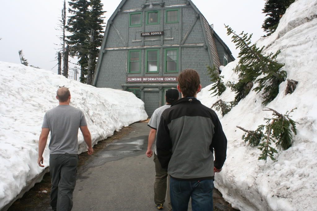
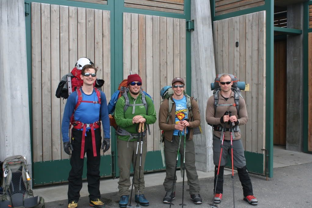
We discussed our route plans with Thomas, who not only sold us the permits but sold us the idea of heading up the Fuhrer Finger instead of the Thumb like we'd intended originally. Apparently, the conditions of the snow would be similar, the incline around the same, but the objective danger would be less. Since none of us were really fans of taking rock hits, we agreed to take his advice. The small crowd of people milling around the trail head was full of tourists there to play in the snow, some amateur climbers making last minute adjustments to packs and gear, and a few hardened climbers and/or guides looking eager to get away from this spot and up the hill. It's funny how you can judge a person's experience on the hill by how weathered their face is - more often sporting a grim expression than a smile - guideface as I like to call it.
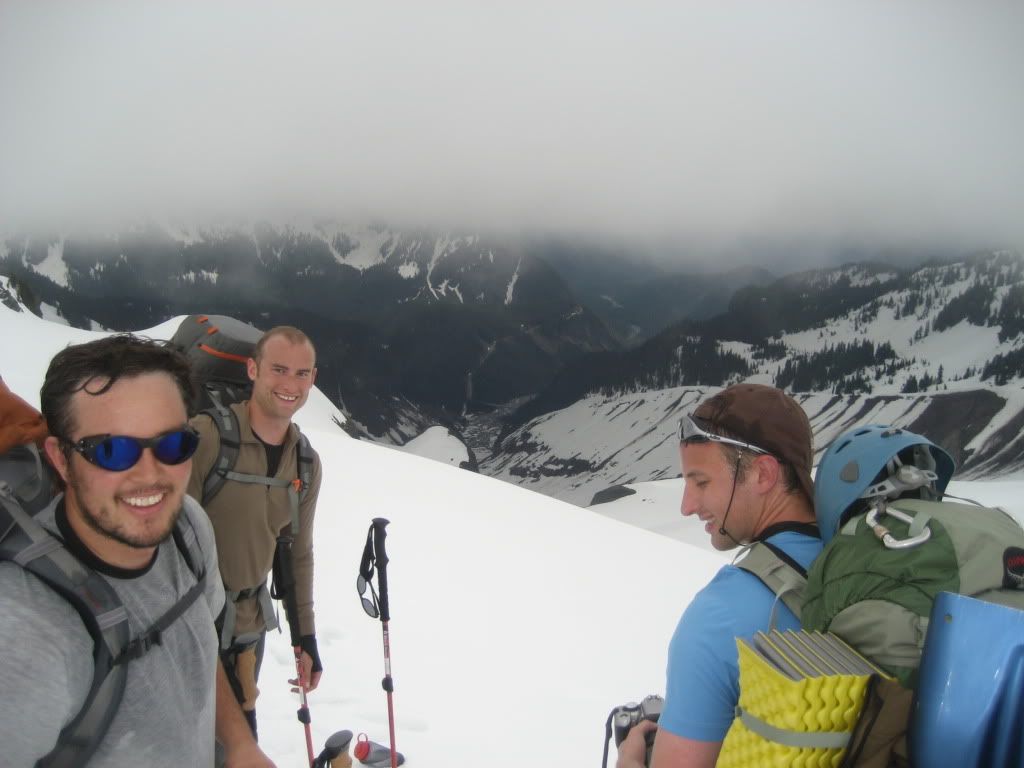
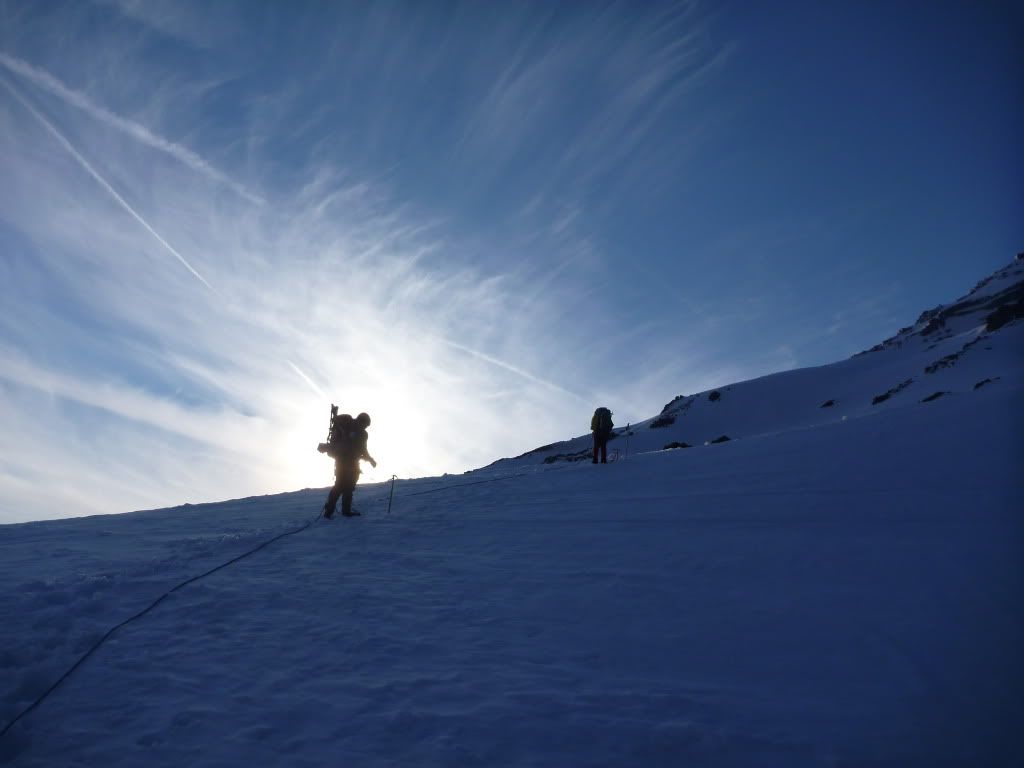
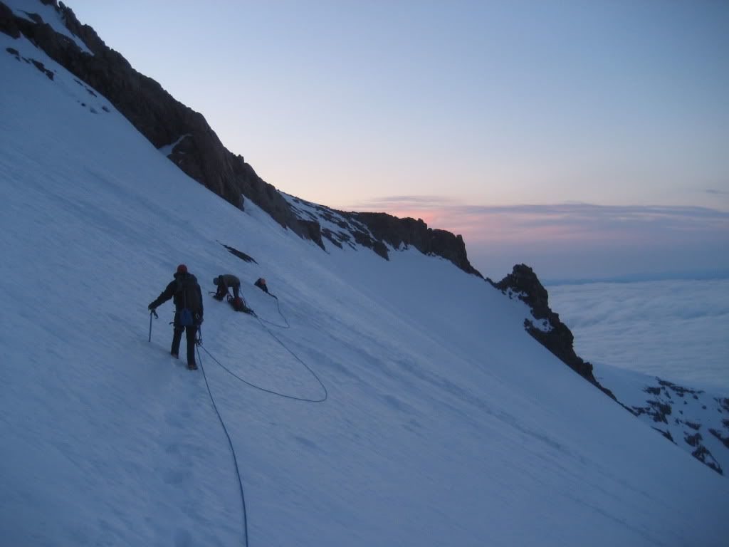
Heading up the hill towards our turnoff at Glacier Vista, we were traveling on snow pounded down by hundreds of boots before us. We would stay on the popular DC trail until we dropped down onto the Nisqually Glacier, so even though the visibility was garbage, there was no way we could lose the trail. It was a little frustrating not being able to see the mountain in front of us as we trudged up the well-beaten path, but several folks coming down said the conditions improved as you climbed. It would turn out we'd be in the fog for a majority of our climb that day - the boot tracks and the occasional wand placements would make our task of route finding a little easier. We blew past the turnoff to the Nisqually by a small amount, but knew we needed to take a big left and descend down into it, so we did and found the trail and a group hiking out as we were going in. They looked exhausted but happy, and after yapping for a few minutes, we passed them and continued along a rolling ridge along the east side of the glacier. Stopping to rope up before we crossed the lower Nisqually, I noticed we were the only climbers in sight. It was a nice feeling but also a little creepy, as you couldn't see very far past Mike who would lead our first leg of roped travel.
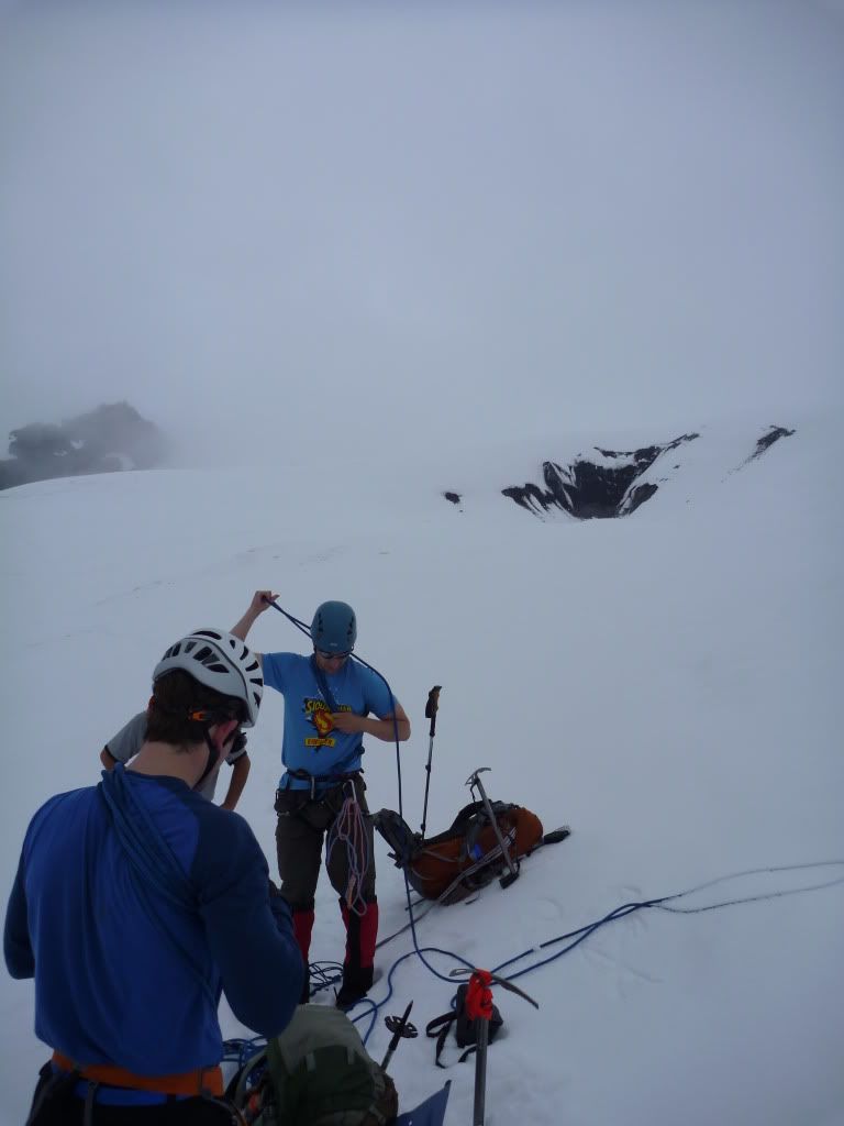
The lower Nisqually provided no real issues for us. The crevasses along the route were nicely closed, so what might be a zig-zag mess of hazard avoidance later in the season was a straight-forward snow walk for us.
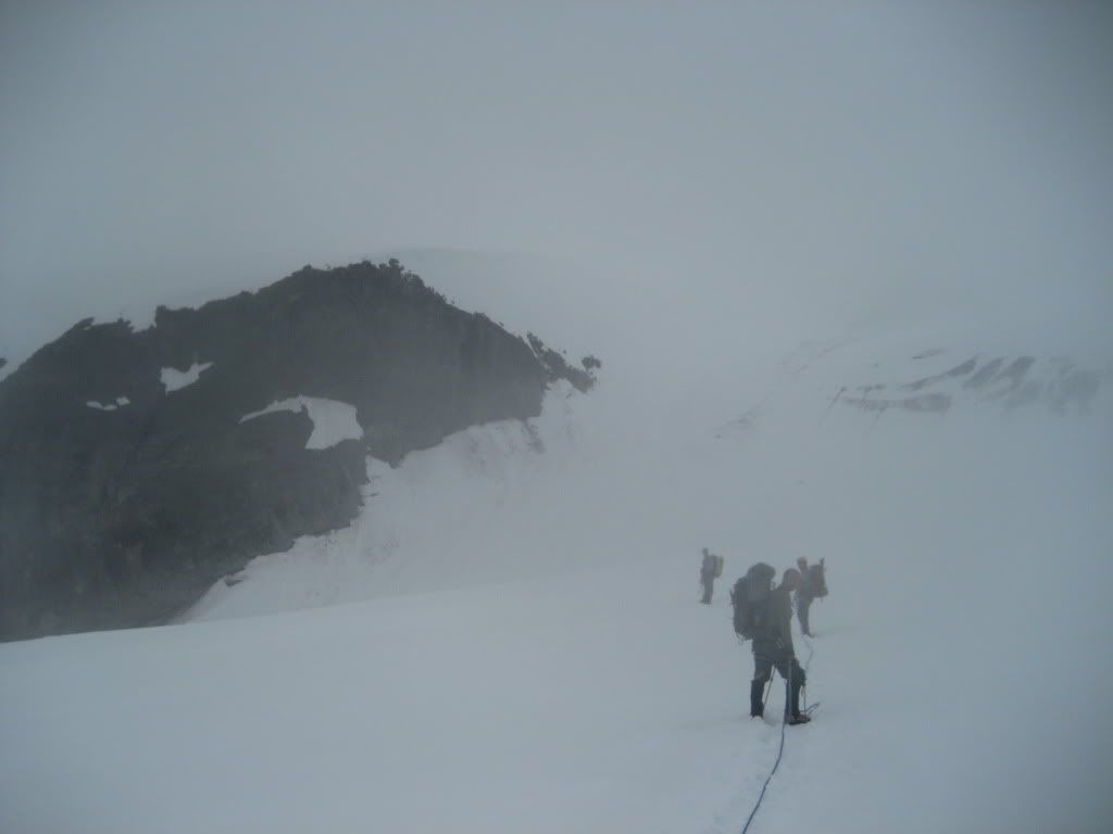
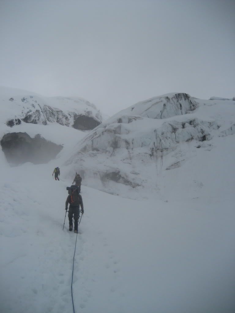
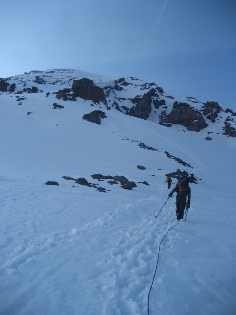
We made good time across and headed up the chute towards the Wilson Glacier. The trail was easy to spot below you, as the early route was actually the same for those wanting to go up the Kautz to gain the summit...the trail ahead was anyone's guess however. Occasionally a wand would appear in the white ahead of you, reaffirming your suspicion that you were on the right path.
The chute was straight forward - steep climbing up mostly consolidated snow between rock and jumbled glacial ice. Even in our base layers, we were sweating quite a bit. I think our pace was a little too fast, but we were all excited to get up to base camp for the night. With the late start, we were battling the setting sun, so the only stops we took were for a quick swig of water or to catch your breath for a few seconds. We stopped once below base camp to melt a quick liter of water - this was the beginning of the signs that I consume much more fluid than the average climber. It's harder to judge on my solo trips, but compared to my compadres - I was chugging agua.
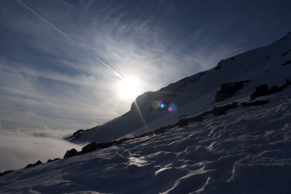
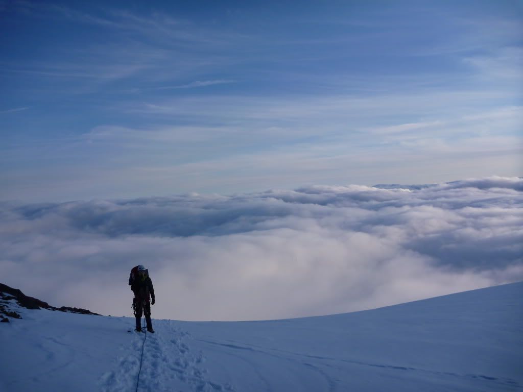
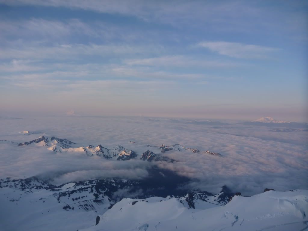
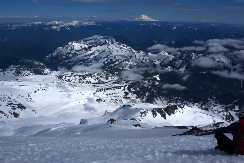
As we crested a ridge about 1,000 feet below our stopping point for the day, the clouds gave way and those killer views began.
We spend the next 1/4 mile alternating between gawking at the jagged ridges cutting the clouds around us, and postholing in small crevasses as we crossed towards a mini-cleaver of crumbly volcanic rock and soil.
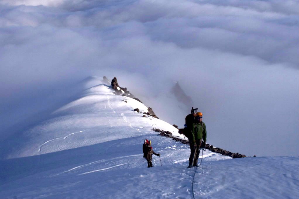
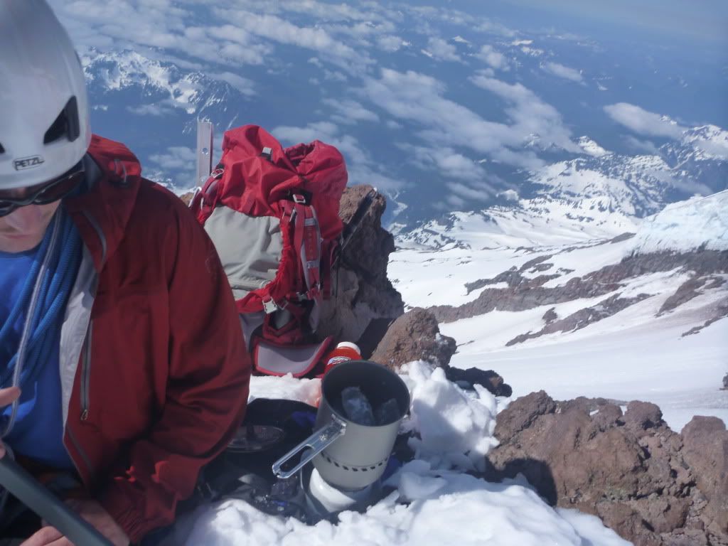
We could see the rocky turret-like formations jutting from the slopes above us, which marked the beginning of the camping areas and most likely where we'd crash for the night. This would also be the spot where the Finger route splits off from the main Kautz route and heads east across the Wilson Glacier. If we wanted to continue up the Turtle snow field, there were several other flat areas to throw down a tent, but climbing any higher would put us farther above our intended Wilson traverse the next morning. Around 9200 feet, we found pre-dug tent platforms, relative safety from ice/rockfall, and amazing views.
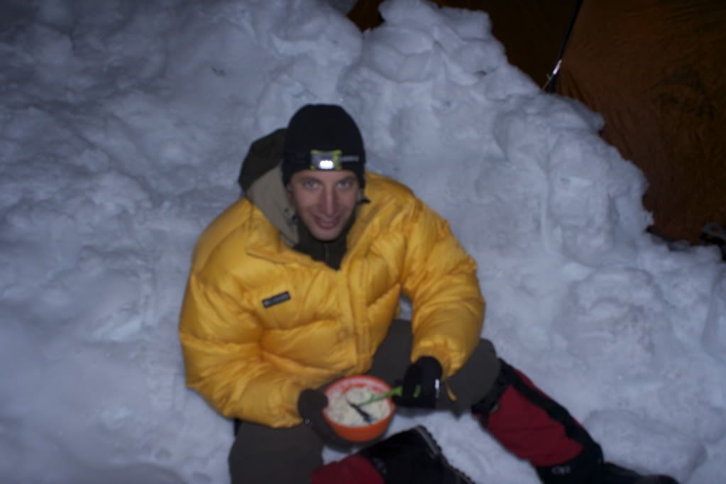
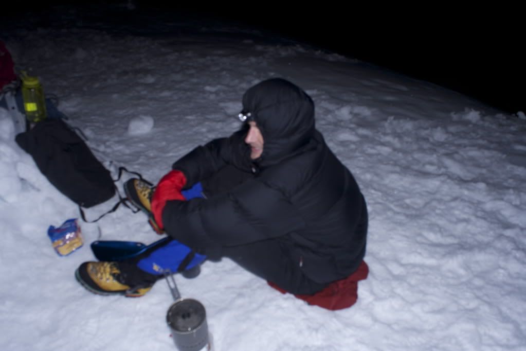
Rope came off, tent/bivy came out, and we settled in for the night. I was exhausted at this point, mostly due to my lack of eating throughout the day. I had no gas in the tank, even though my muscles weren't really fatigued. The temperature dropped quickly as the sun sank below the horizon, so we made haste for the sleeping bags after a little food and water.
We got to bed much later than I hoped we would, which was the beginning of the trouble we'd see later in the trip.
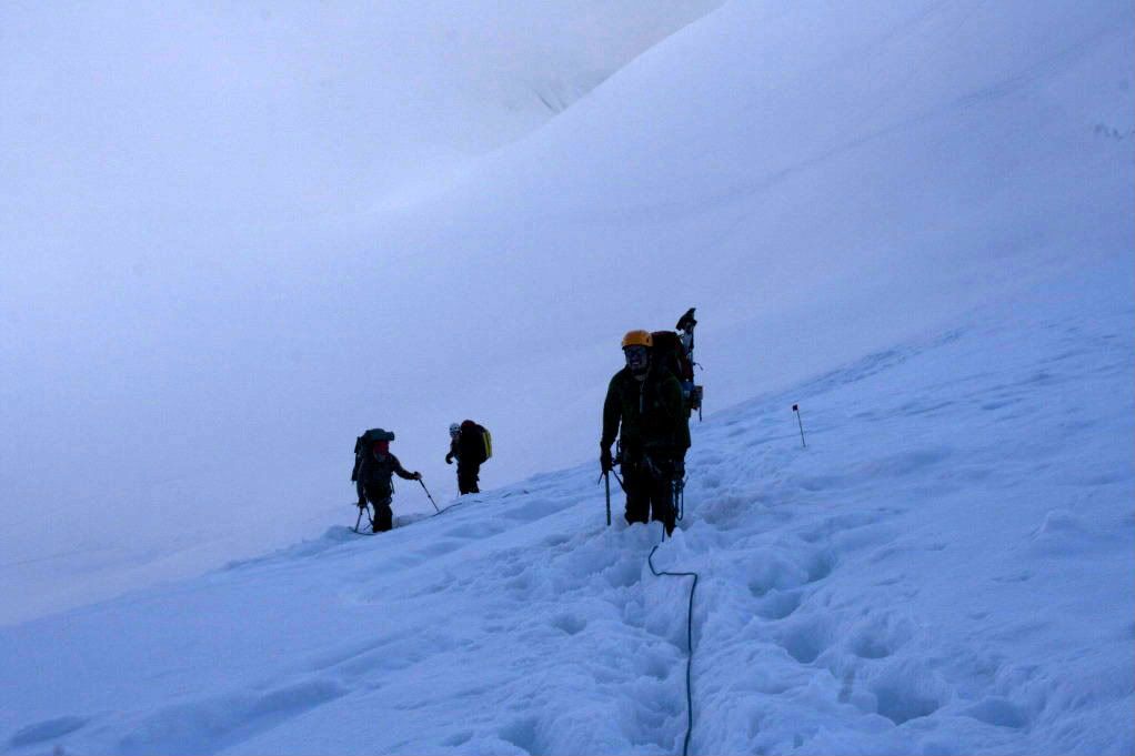
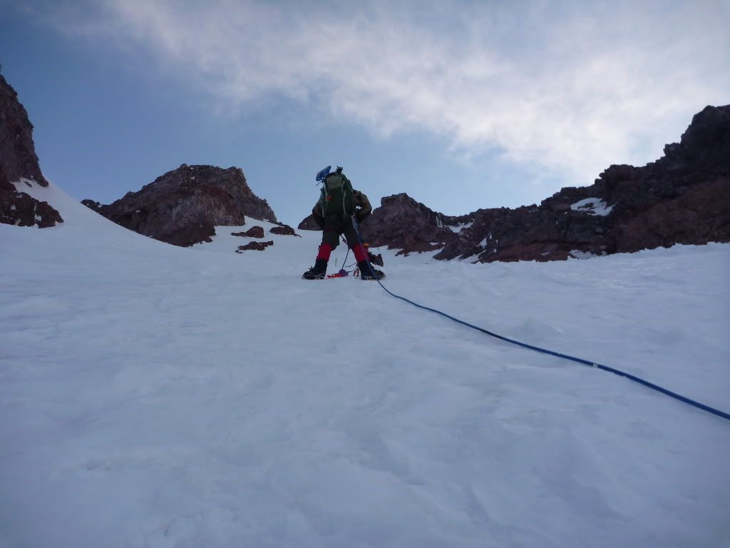
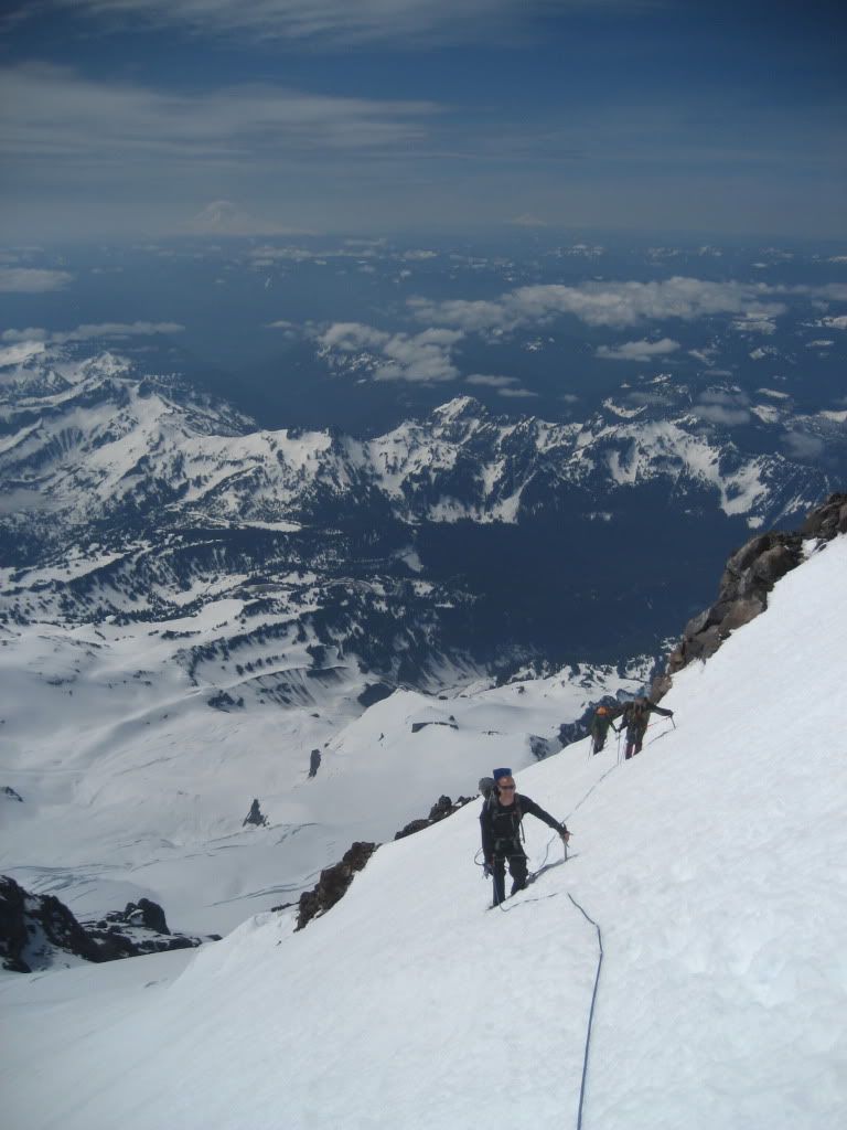
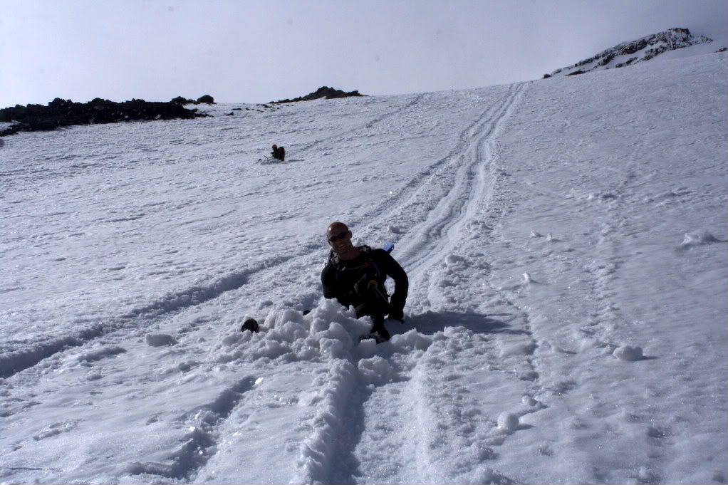
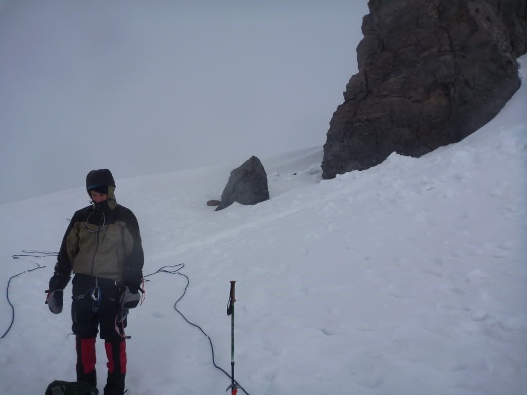
Except for maybe Mason, we had all been running on very little sleep. We decided to get up around 4 instead of 1am like we should have, and we were on the climb about 430am. In retrospect, this was way too late to be getting started, but we'd had a late start from the trail head the day before, so it was either sleep a tiny bit yet again, or risk the dangers associated with the warmer temps that come later in the day. We all later agreed that we chose poorly, but we can't go back and change it. The Wilson Glacier crossing was uneventful, and as we traversed we passed enormous crevasses on the uphill side, several meters wide and who knows how deep. They were easy to see and thus easily bypassed, but we didn't linger for even a picture here.
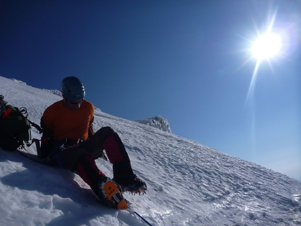
We put on our crampons for the first time all trip at the base of the Finger, and with Mason at our lead, we began the ascent of the chute that would ultimately lead to the west side of the upper Nisqually glacier. It was such nice going - I alternated between french technique and front pointing to save my legs, and we all commented on how much we were enjoying this portion of the route.
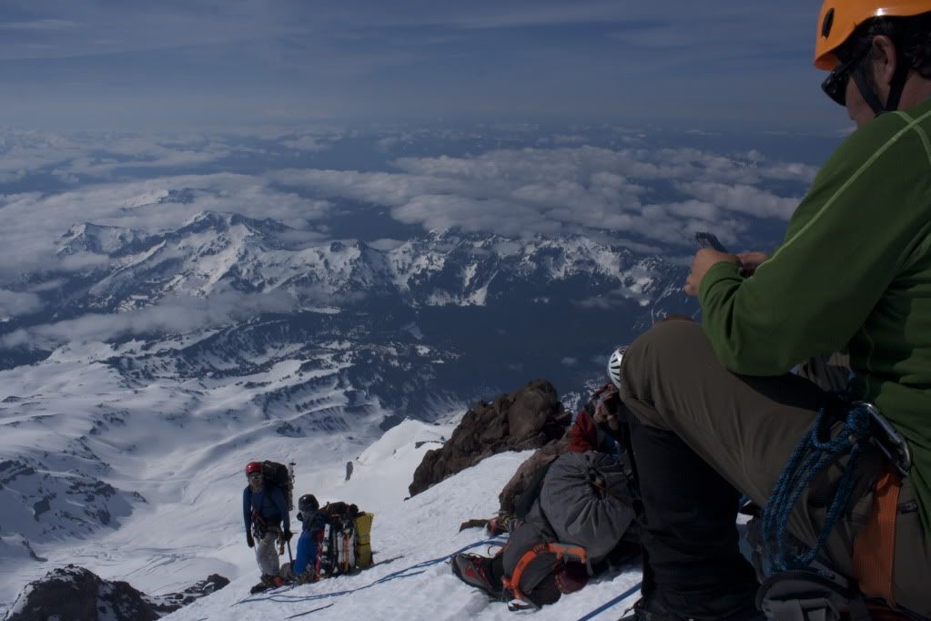
To this point, there had been no real noise of any ice or rock fall in the surrounding area, but we kept our head up just in case something came loose above. Behind us in the distance, we could see two more climbers crossing the Wilson roped up. We would cross paths several times with these guys before the day was up.
The light of the sun was already on the cliffs above the Finger, but we were still shaded and I was feeling great that we'd come so far without having to dodge anything. About that time, the aforementioned rock we now refer to as the Wake-Up-Call came roaring into sight and cut our group in half. We yelled again down the chute to the climbers below, hoping they'd have the same luck and miss a collision. They did, and we turned our focus back to getting out of the danger zone as quickly as possible. We were almost out of it and onto the more gentle slopes above the Thumb/Finger intersection, but we were beat from the long way we'd just come up. Just then, another grapefruit sized rock came whizzing down, smacking Mason in the heel and then glancing off Mike's axe into his knee. Both guys were hurt but able to continue, which is exactly what we had to do - get up and out as fast as possible. With all the adrenalin pumping, it made charging up the last 25 meters or so a little easier. We crested the steep portion of the upper chute, and our line of sight now included the rock walls where these rollers were originating from before they careened down the Finger or Thumb.
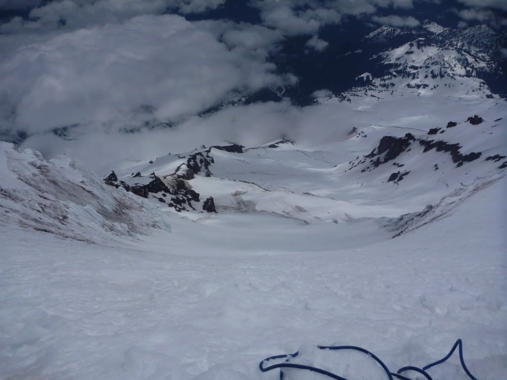
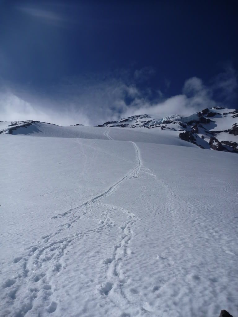
Our path took us east and up past the rocky walls above to the west edge of the crevasse-torn Nisqually glacier, and we stopped to rest on a moderate slope just below a few enormous snow bridges spanning shallow crevasses to the snow slopes above.
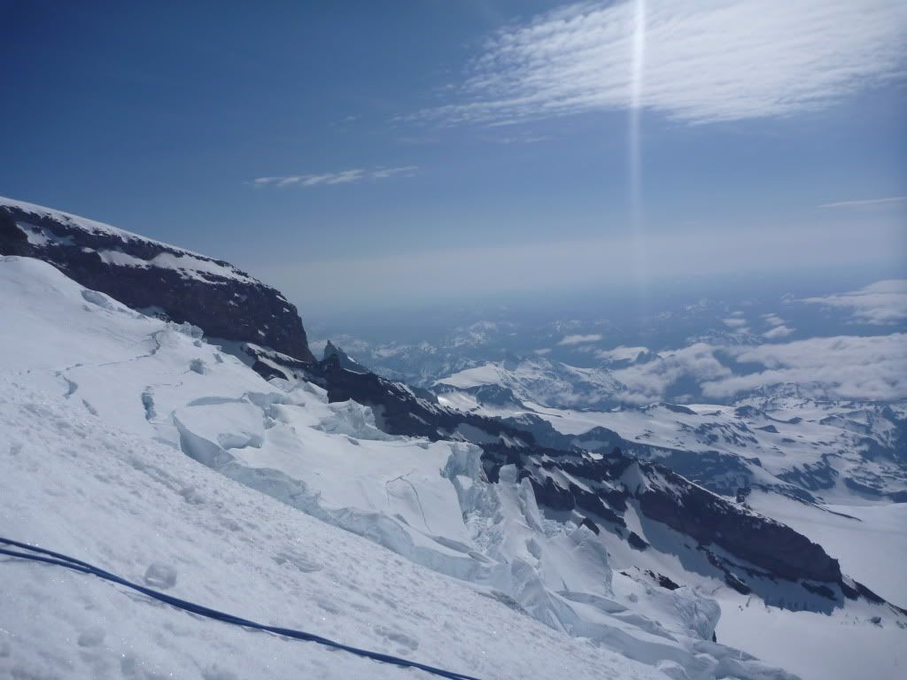
I'd estimate our elevation to be just shy of 12,000 feet at this point, so we still had about 2400 to go. We settled down a bit after our near-miss, caught our breath, and zig-zagged across the shallow crevassed area to the firm steep snow above it.
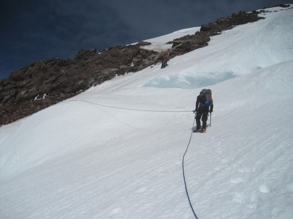
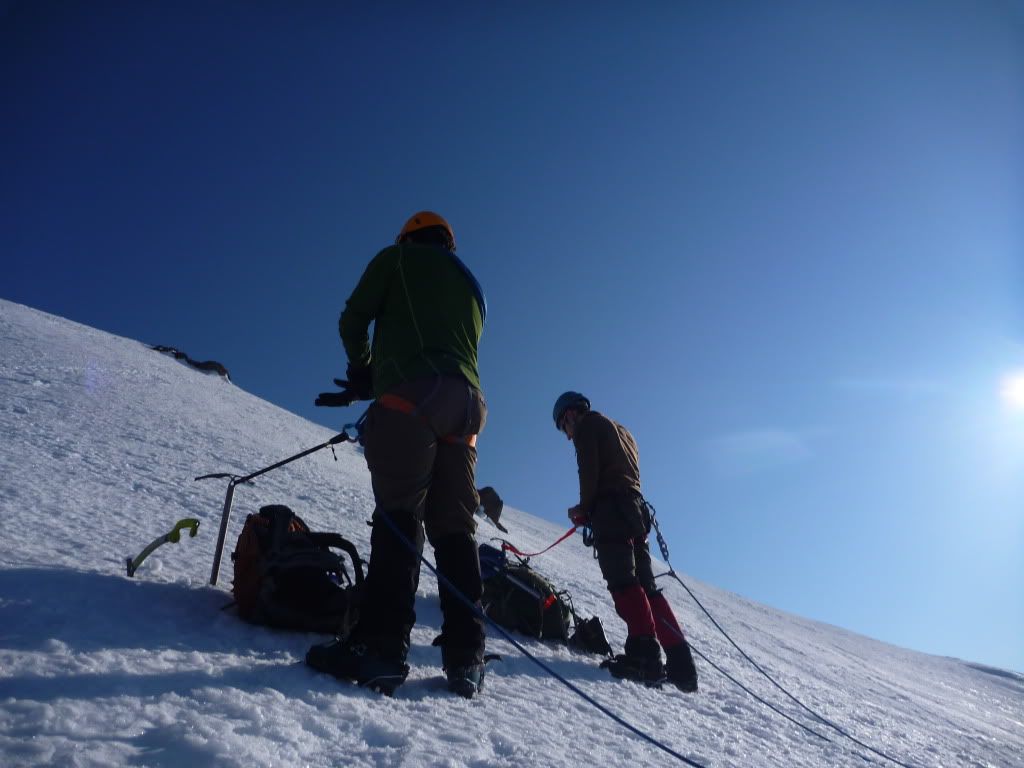
After a couple hundred more feet, we came to a rocky area that required a left/right decision to continue. Go left, and you're under an obvious shower of rocks while you traverse a steep slope of snow. To the right, you traverse an enormous 45-50 degree snow slab with a long runout into what appeared to be bottomless crevasses. We decided to sit, melt some snow and consume some GU (Mason's best friend), and think about it for a bit.
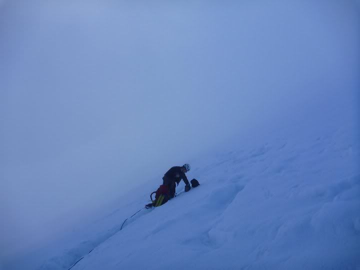
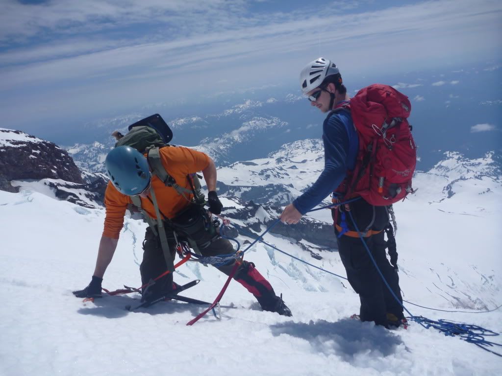
Right it was. Mason relinquished the lead at this point, so I took our two pickets and some runners, pulled my hammer off my back for the pickets/traction, and headed off across the exposed traverse.
While we were sitting, the two climbers below us actually passed us up, but they were moving very slowly across this slope. We had the advantage of the 60M rope vs their 30M rope, so it seemed to make the traverse a little faster. I asked if I could pass below, joked that I would kill them if they fell into our rope and dragged us down, and quickly moved past them along the steep somewhat slushy traverse. The rest of the team quickly followed behind, leaving little slack in the rope as we did in glacier travel. As Mason gathered the last of the pickets, I brought the group in on an axe belay so I could collect pickets and move upward in a more direct 2nd pitch. At this point, the sun was beating down on us, and I was sweating like a beast. The gloves were off, and with axe and hammer in piolet manche position I kicked up the 2nd pitch as fast as I could. The route became steeper, and the exposed skin on my knuckles was bleeding from contact with the slushy ice. Jesse, who was right behind me, had the same issue, but we weren't complaining - we wanted off that slope. The entire team made great pace on the last 30 meters or so, and we were soon above the slope on a gently sloping area several hundred feet below the intersection of the Kautz/Finger route.
The pickets went back on the pack along with the 2nd axe, and we slowly booted up the steep snow from there towards the top of the Kautz glacier.
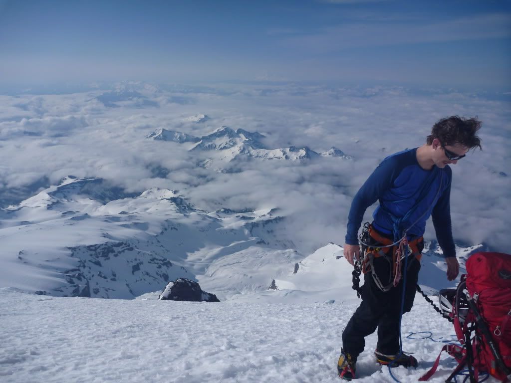
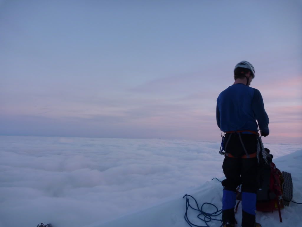
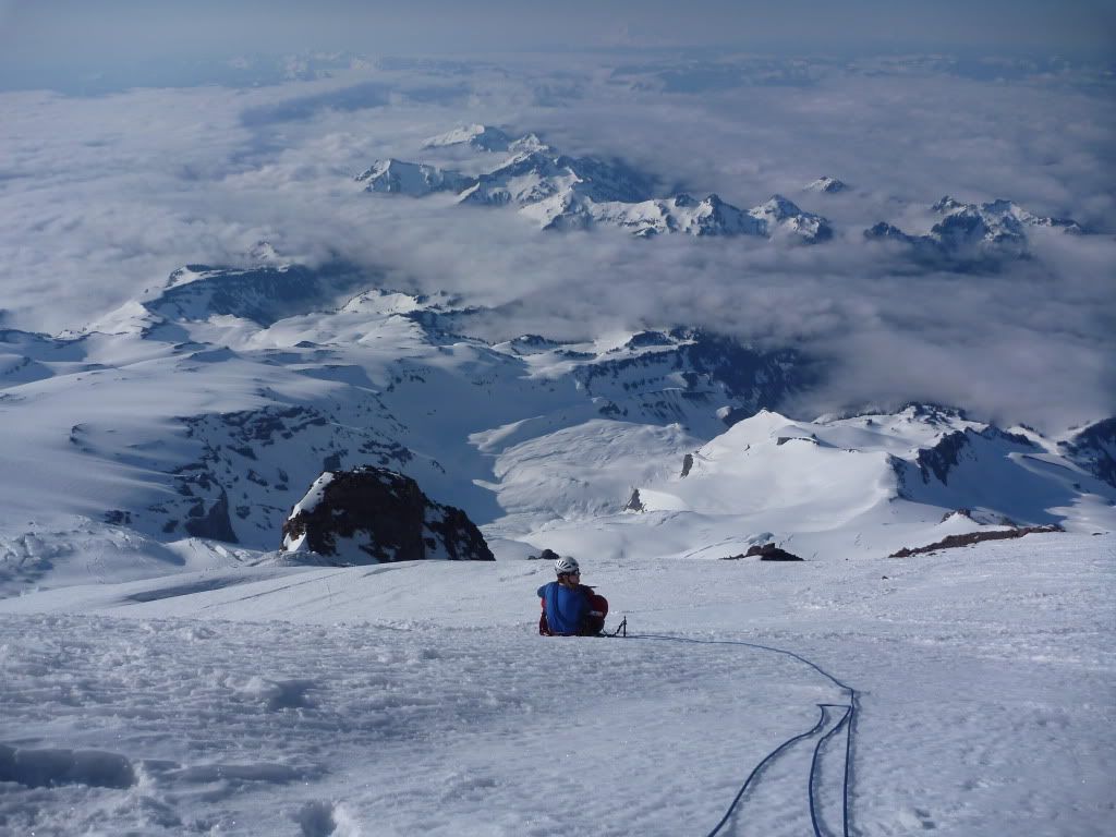
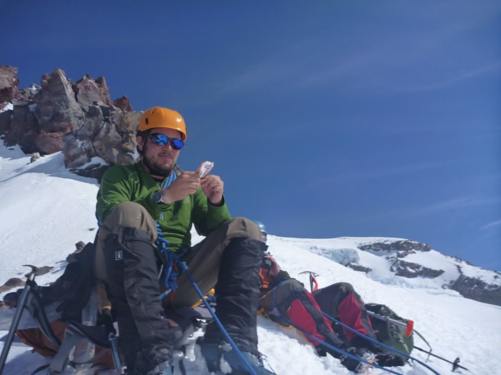
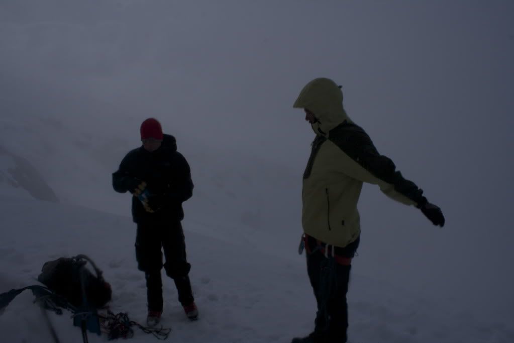
By this point, I'm starting to not feel so good. I'm obviously moving more slowly than the rest of the group, and I'm just feeling a little off. We entered another flat region as the Kautz route appeared from the left and crossed our path, so we stopped to catch our breath and check the elevation. 13,000 and some change. I declared that it might be best for me to not continue upward. I felt weak, my balance was a little off, and even though I didn't notice, I was talking in short phrases and asking the same thing over and over, not really retaining the answers I was getting from the other guys. Now we had a problem. It was pretty clear I needed to go down. Mason, Mike, and Jesse were all feeling decent and could make it up the last section to the summit, but they are also responsible guys. Jesse, who could probably have just carried me up the rest of the way, wasn't too concerned with the summit - he had enjoyed the whole way up, the views, the challenge. Mason and Mike were hungry to finish, but they were no fools - they knew that splitting up on a big mountain is probably not the best idea if one of your guys is feeling off. Even if I waited down here for them to return, they might not for some reason...weather, injury, who knows? I would be stuck without a rope and a partner, probably getting more loopy as time progressed. Although I tried to talk them into leaving me, they made the right choice to head down together.
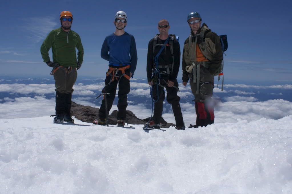
So...we did. We took a few pictures of our false summit, discussed a game plan, and headed off down the upper Kautz towards the big steps and ice cliffs below. It was smooth sailing over uninterrupted snow for the first part of our decent. I floundered along, telling myself that we just had to go down and I'd feel better. Jesse was leading the roped team at this point, and as he approached the top of the upper step on the Kautz, we slowed down the pace and he carefully made his way to the edge - found a dyneema runner we could use for a little extra safety as we descended the steep step.
At this point, I'm starting to feel quite a bit better, and I wasn't confused or loopy like I was way up above. We clipped a couple biners into the runner, and I lowered each member down with the single length of the 60M rope. This was a little anticlimactic, as there was so much snow covering the step that you could really just plunge step the whole way safely. In the later season, this would be some pretty dirty ice I'm sure, but we had easy conditions. I rapped down 30M and then plunge stepped down the rest to the group. We tied into the rope quickly and walked the rest of the way down to the top of the lower step. As we reached this section, Mike decided he wanted to just axe belay us down for extra safety. This is where it got a little dicey.
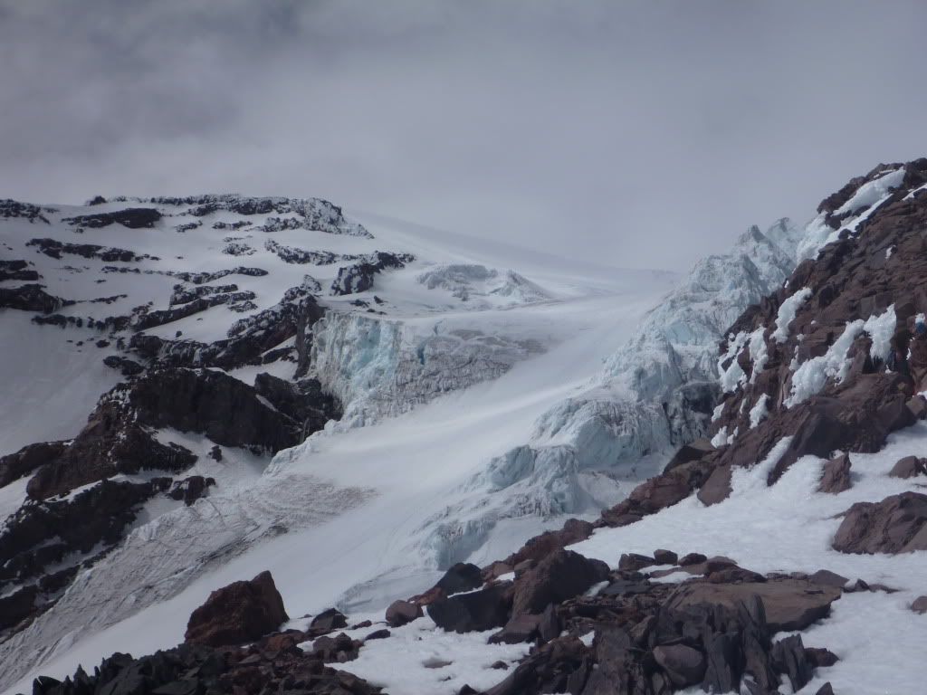
We quickly realized trying to be safe and move slowly down this steep snow-covered step was putting us in probably more danger - lingering below the small seracs that lined this portion of descent was probably the greatest danger to us. In addition, we needed to hurry down to the base, hang a quick left and ascend up the Kautz Chute, hopefully avoiding the enormous seracs that loomed over that gully, ready to randomly break free and kill anything below. As Mike worked the slow belay, we discussed just forgetting it and booting down, etc etc. Just then, the Kautz made our decision for us. A loud CRACK to our 5 o'clock sounded, and a serac the size of a dump truck broke off the face and crashed down the slope below it, rumbling along in a river of icy destruction. Luckily for us, it happened to fall on the section just to the west of the slope we were on, but it woke us up just the same.
( The video below gives you an idea - this is not from our trip, the serac fell on the opposite side of the kautz from this, but you can see why ice is not your buddy )
We instantly picked up speed, moving down the slope as fast as we could go. Mike and I ended up sliding on our butts for the last 15 meters or so, and we all came to rest where the Kautz chute took a hard left and headed up below the really sketchy part to Camp Hazard. ( This is the chute seen in the video above, getting destroyed by the river of ice)
There wasn't much time for discussion, but I'd read there was a nice bypass for the chute up a small rock face almost directly across from our current position. We thought we could see it, so instead of taking a left up the chute, we bolted across the debris field that lay below the ice cliffs. Mike and I fell several times as we scrambled across the serac scoured snow field below the chute, the slushy meter deep ruts didn't provide much for good footing. Out of breath, we stopped running as soon as we felt we were out of the path of potential icefall, but there was no real time to rest here. We needed to get up the bypass ( if it existed ), and get out of the way of all this. I ran from the rear of the group to the front, and headed along the base of the loose rock cliff above to where I thought the bypass was. I could see a semi-exposed notch with a little easy mixed climbing below it. A couple old fixed ropes peeked out from the melted out spots, but they were no real use to us. I pulled out my hammer, ducked below the slight overhang, and slopped my way up the bypass to the platform above. It really wasn't that bad, the only tough spot was ducking below the cliff beside and over you as you scrambled up the short route. Once on top, I did a quick hip belay and the rest of the group followed with no issues. I think Jesse made it up with his bare hands per usual.
Relatively out of danger, we stopped to drink and discuss the rest of the way down. We were about a hundred feet or so below Camp Hazard, and opted to rope up for a little while longer even though we didn't think we'd run into crevasses. We wanted to make sure we were truly off the glacier before we untied and descended the rest of the easy snow back to our camp at 9200. After a short stint of walking roped up, we came to an excellent vantage point and determined an unroped glissade would be the path of least resistance and didn't offer a whole lot in the way of extra risk.
The turtle snow field and the snow slopes below down to 9200 proved to be the smoothest and most enjoyable ~1600 feet of descending I've ever experienced. We all had huge smiles on our face as we slid down towards the tent over the rolling slopes. It was a great way to end a stressful day on the hill, and the lower we got, the better I felt. As we gathered in our camp, huge amounts of food were consumed, snow was melted for the next day, and we all settled in for the night.
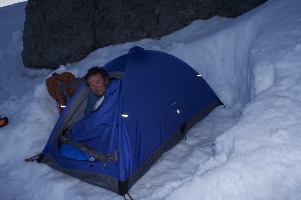
Although Mike has discovered his bivy sack didn't quite keep his bag dry, after some time in the sun we guessed it would be enough to get him through the night.
And the weather turned.
Mike quickly learned the shortcomings of his new bivy sack that night. The wet snow and wind turned to cold rain and wind as a slightly warmer front moved in. I got up in the middle of the night to toss my pack cover over his pack and my shell jacket over his head, but I think the damage was done. Mason, when he heard it pick up, had already sealed up his pack and moved it outside, making room in his superlight shelter for Mike if he chose to come in. Jesse and I were sleeping like champs in the Dragontail, which only needs slightly less footprint than an aircraft carrier, and we had a pretty decent night. Mike got up soaked.
His bag was soaked, his clothing was almost all wet, but I don't remember a peep from him. We needed to get down quickly - none of us had any desire to be out in that cold rain and sleet any longer than we had to. Visibility was terrible, and after camp was on our backs, we roped up and I headed down the hill with the gang roped up behind me.
Our route was fresh in my memory for the most part, and we could follow some old boot tracks and the wand that would show up from time to time.
As we crossed a small rocky section and onto the snow ridge beyond it, I had trouble remembering exactly where we had come up the steep slope on the far side of it. I didn't really see a distinct boot path in the cruddy weather, so I got the ole GPS out to see how far we were off track. I miscalculated our direction and headed down a much steeper section than I think we came up, and Mike and Mason came flying down behind Jesse and I yelling to get our butts moving. They were afraid the top section of the slope was going to break off and come down on top of us, and the two of them actually slid down the last portion together in a small wet slide. I felt like this was some strong logic, so we made haste for a spot out of the way of potential avalanche danger. Of course, once there, we spotted the normal trail marked with a wand coming down from a less steep section of the slope near some crevasses. We continued on.
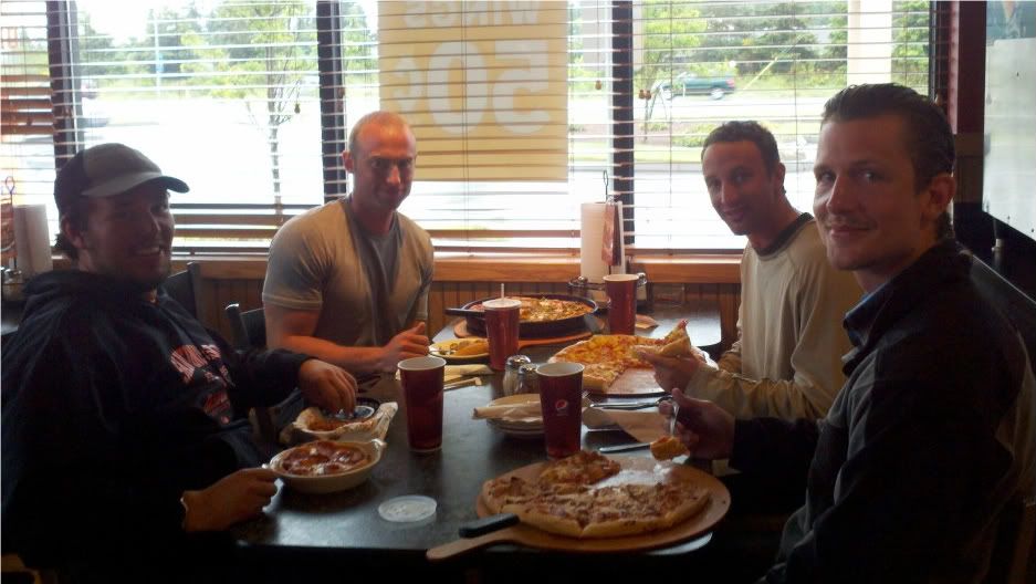
The rest of the descent was mostly a soggy wet slog through the mist and the fog - it was difficult to see where we were going or what was ahead, but we kept up a decent pace and eventually found ourselves on the rolling ridge again that borders the lower Nisqually after crossing what seemed like the endless lower portion of that glacier. Rope came off, and Mike, already miserable from being soaked through, volunteered to carry the heavy wet rope up and out of the glacier valley and back to the truck. The kid is a champion. We joined the main DC trail again, passing a few brave souls heading out into the weather - looked like dayhikers if anything, and after 20 minutes or so were back at the Ranger station, tired and wet, but alive and satisfied with our climb. We prescribed my WM down jacket and thermal pants for Mike to get his core temp back up, and decided our time would best be spent in the coming hour or two consuming as much mediocre pizza product as possible. I did my part with an entire large pepperoni and onion pizza. Until next June...