I cheated

Archived TRs for ranges in California.
Post Reply
User avatar
lilbitmo
Posts: 1092
Joined: Tue Mar 04, 2008 9:44 pm

Post by lilbitmo »

I said I would go do the Baldy Register Ridge or the Face of Baldy but my hiking buddy called me Thursday night and suggested San Jacinto - No parking issues or road issues (black ice on the Baldy road up to Manker Flats that early in the morning would have been hell).

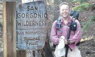
We caught the first tram up and were past the ranger station in Long Valley by 8:30. The snow in Long Valley was 3-4 feet. We actually caught up to a ranger that was struggling with his own snow shoes (he saw me coming up behind him and decided he could go without them for a short time) as someone had done a fine job of packing the snow down the day before all the way to the split by first sign post (not all the way at the creek but the sign post before that).

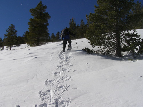
Tracks went in three directions at this point and the snow was no longer packed down so we put our own snow shoes on at this point- we took the one in the middle and followed them up over the ridgeline keeping the water drainage below us and to our right, with Cornell and the rocky crags just to the east of Cornell over our right shoulder.

The tracks were ok all the way till the woods that split Tamarack Valley from Round Valley. The tracks then went due south and someone had started to head towards the base of Miller Peak but turned around after ten steps. It was at this point Bryan T and myself started cutting our own tracks - shortly we came across the top of the brown pole that indicates that Tamarack Valley is to your right - but it was buried up to the vey top and I could not tell if that was the correct one.

From there we made a bee line directly below the south facing face of Miller Peak, then we took turns zig zagging up the facing of Miller Peak and cutting fresh track but doing in more on the West face in the area that leads up to the Saddle that separates Miller from San Jacinto.

The snow was very soft and even with snow shoes and the wind and cold we were breaking through up to one feet with snow shoes on. When we reached the area of the saddle it was at this point that I told my hiking partner that I had hit a wall (had been sick for two weeks leading up to this hike and was still weak - could not get my legs to go uphill any longer) and would wait for him while he finished the summit approach.

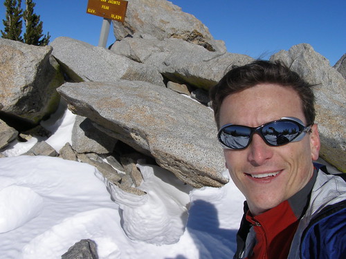
Twenty five minutes later he was back with that big grin on his face. The summit was his and he had done more than half the tracking cutting on the way up the face so he deserved to be the first one to summit in the fresh snow. Five minutes after he returned and repacked two more hikers came up and thanked us for cutting fresh trail that they had been following for two hours and would we please "Glaissade down" and leave them big gulleys to ride in on the way down, we laughed and said sure.

After Bryan had left for the top I tried to remove my Snow shoes and walk on the snow again just to see if the wind had stiffened it up enought to just coast across the top but no way, I sank up to my waist or higher on every step, no only that it was so wet at the lower reaches that it grapped ahold of my feet and made it very difficult to pull each foot back out.

On the way down we tried glissading but that didn't work either as the snow has not had enough time to get more compact and we just sank in and didn't get but five feet each time.

Needless to say we enjoyed a great day, when we got back to the split down between Tamarack and Round someone had come up the water drainage short cut (by the first crossing of the creek) and I was familiar with that short cut so we followed that down - near the bottom someone had attempted to post hole there way up or down not sure which but they had been sinking in at least 4+ feet and it was very very soft snow near the bottom.

I'm running out to church and will post pictures later today as my computer guy fixed my home computer and brought it back to me last night when I got back from the hike. :D :D :D :D :D

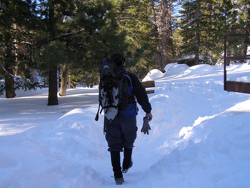
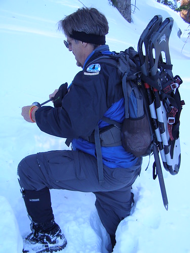
Walking Past the ranger station on our way to the summit!
Image
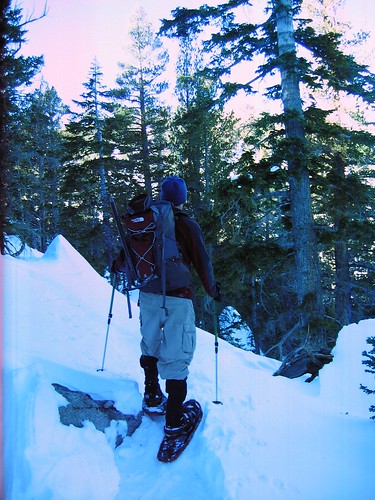
No more hard pack, time for the snow shoes. No Post holing here 8)
Image
Bryan just ahead at the turn for Miller Peak just southwest of Tamarack Valley
Image
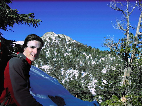
Bryan with Miller Peak in the background
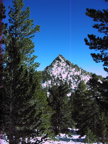
Image
Cornell Peak
Image
The old guy going up Miller West Face
Image
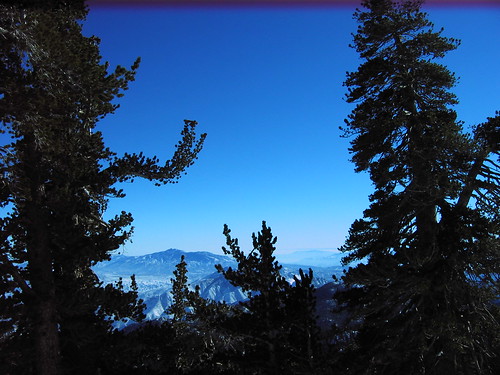
A view south through the trees when I quit 50/100 feet below Miller/San J Saddle
Image
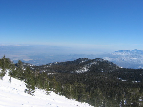
A view South East from near the saddle
Image
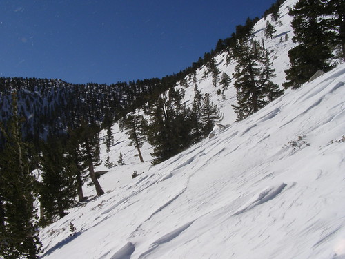
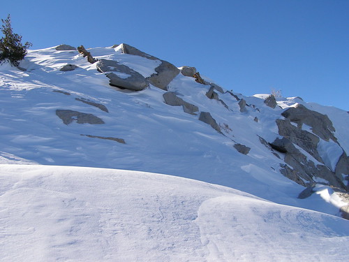
Just below the saddle with wind drifted snow - it was blowing in our faces hard at this point - about 20/30 miles per hour on each gust.
Image
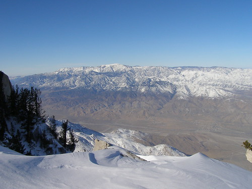
Looking Due south below the saddle with all the peaks dusted with snow.
Image
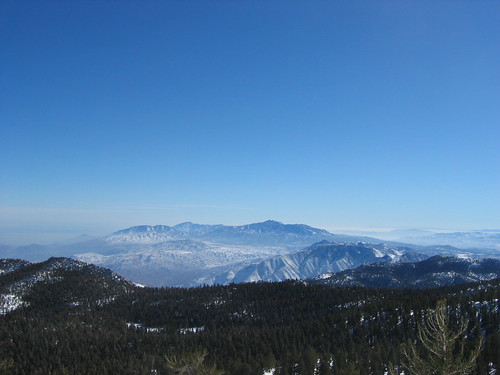
The San Bernardino's across the valley with all the dusting we come to enjoy
Image
The last ten feet below the summit
Image
Bryan gettnig a self portrait at the summit
Image
User avatar
simonov
Posts: 1087
Joined: Tue Nov 27, 2007 5:44 pm
Location: Reno, NV
Contact:

Post by simonov »

Man, I need to get some snowshoes this year.
Nunc est bibendum
User avatar
Hikin_Jim
Posts: 4686
Joined: Thu Sep 27, 2007 9:04 pm

Post by Hikin_Jim »

I thought your story sounded familiar. Take a look at this post on the San Jacinto forum: http://www.mtsanjacinto.info/viewtopic. ... 6&start=23
User avatar
lilbitmo
Posts: 1092
Joined: Tue Mar 04, 2008 9:44 pm

Post by lilbitmo »

I think you are right HJ I did speak to Kathy as I returned my permit to the "Return Mailbox" as I was passing the Ranger Station.

Thanks for the heads up.

:D
User avatar
KathyW
Posts: 212
Joined: Thu Sep 27, 2007 9:00 pm

Post by KathyW »

Nice meeting you guys out there. I'm really impressed that you made it to Miller Saddle/the Summit. We only got as high as 9900' - just above Wellman's Divide. Breaking trail was a killer.

In my opinion, Baldy via the Bowl is not necessarily harder than San Jacinto via the Tram in the winter (it just depends on the snow conditions and if the trail has been broken on either mountain); so I don't think you did much cheating. This weekend was probably pretty tough no matter where you went though.
User avatar
lilbitmo
Posts: 1092
Joined: Tue Mar 04, 2008 9:44 pm

Post by lilbitmo »

I should have clarified the word cheating.

I meant that I went into another wilderness after telling a new guy to the board EnFuego that I was going to do the Bowl or Register Ridge on Baldy and instead went over to the San Jacinto wilderness.

As far as difficulty, I have to imagine that it was difficult everywher hikers/climbers went with the softness of the snow. As you stated, we sank in on almost every step that we cut except those areas that we were extremely steep and exposed to the wind, we had to kick in harder at those areas just to get a hold.

My hiking partner Bryan that was with me has become a great team member, he's young yet catious and understands the dangers. He ended up doing about sixty percent of the breaking trail as I was still feeling the lingering effects of being sick for two weeks - And I was darn glad I had him with me - as I cramped up badly right below the Miller/San J Saddle.

Nice work for you and the rest of the rangers to break trail to Wellmans, that will help keep others safe and give them a chance to go out and see how beautiful the desert mountains look with snow on top of them. That view is outstanding in the winter.

Once again Kathy it was nice to meet you finally.

Lilbitmo :D
User avatar
EnFuego
Posts: 677
Joined: Mon Dec 15, 2008 11:14 am

Post by EnFuego »

lilbitmo wrote:I should have clarified the word cheating.

I meant that I went into another wilderness after telling a new guy to the board EnFuego that I was going to do the Bowl or Register Ridge on Baldy and instead went over to the San Jacinto wilderness.
Lilbitmo :D
Darn right you cheated. I was waiting at Baldy for you for 6 hours before I finally did my own hike. :lol: I'm kidding. I knew you wanted to do Baldy, and I thought I might get an invite, but didn't hear from you. No worries though, I've been pretty busy with work, and holiday shopping. We should do something soon though. Keep me posted of your itinerary and I'll let you know if any of your hiking days coincide with my availability over the next week or so. After January 3rd, I'm only available weekends. I'd be up for a night hike though during the week if you want.

BTW - awesome TR. Looking foward to your pics.

~EnFuego
User avatar
lilbitmo
Posts: 1092
Joined: Tue Mar 04, 2008 9:44 pm

Post by lilbitmo »

Sorry for posting the pictures late, I had computer down at home (fixed now) and was slammed at work.

They are in the original post above.

Enjoy

Lilbitmo :roll:
User avatar
406
Posts: 319
Joined: Thu Jan 17, 2008 10:36 am

Post by 406 »

nice photos, good to see that much snow in the San J.
User avatar
Hikin_Jim
Posts: 4686
Joined: Thu Sep 27, 2007 9:04 pm

Post by Hikin_Jim »

Cool pix. Thanks for posting them. What's that patch on your left shoulder? Looks sort of like a PCT symbol. And what's the small sort of crescent shaped patch below that?
User avatar
lilbitmo
Posts: 1092
Joined: Tue Mar 04, 2008 9:44 pm

Post by lilbitmo »

In 2004 when I started hiking a friend talk me into doing some sections of the PCT - so we started at the Terminus (In Campo) on the border of Mexico. The big patch is in support of the PCT (not that I've done the whole thing) the smaller one just below it is the first section completion patch - section "A".

I have not got around to putting on the other two - Sections B and C which I've completed.

I'm right near the end of Section "D" as well.

In the fall/winter of 2005 - 2006 I did from Coon Creek in the San Bernardino's to Mill Creek Crossing in the San Gabriel's with my dog Lucy Solo - we did 10 hikes to cover that ground - it was a blast. My friend stop going when we got to Coon Creek, he was not getting any faster, was still smoking cigarettes and I was losing weight fast, my pace had increased to over 3 miles an hour and I was looking to just go "Balls Out" as they say - he started making excuses, so I just kept going on my own.

Funny you should ask HJ, I took my daughter and a Psuedo Nephew to the terminus (the start of the PCT on the Mexican border for those who are unfamiliar) on Saturday and up over Mount Laguna for a fun day checking out the beauty of the San Deigo Desert Mountains. You would not beleave the amount of people on top of Mount Laguna - it was wall to wall people from San Deigo - it took 28 minutes to go from just before the turn in Julian all the way through town less than one mile of distance.

There's a web page that has patches for the PCT if anyone is interested - I will try to find it since I had to redo my "Favorites List" when the computer went down.

Lilbitmo :D
Post Reply