Square Top

Archived TRs for ranges in California.
Post Reply
User avatar
tekewin
Posts: 1194
Joined: Thu Apr 11, 2013 5:07 pm

Post by tekewin »

Square Top is a remote peak in San Diego County, #34 on the SD Sierra Club list. It only gets a few visitors a year. It is also the only peak on the list with a class 5 summit block.

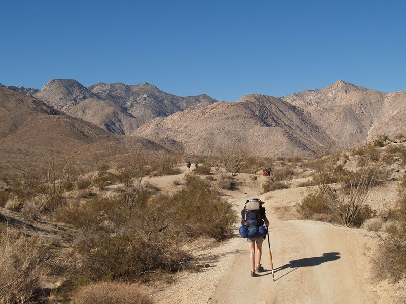
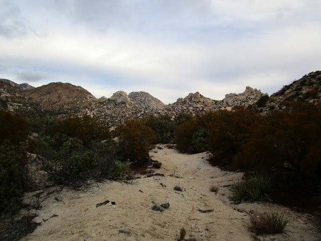
I wanted to do this solo as a test of my novice rope skills. The trail started by descending into Cougar Canyon. Once you get into Cougar Canyon, a faint use trail comes and goes, but it is generally easy to follow even if you lose the use trail. I crossed water in the canyon several times before reaching the point to leave the canyon and head toward the granite pinnacles guarding Square Top. I skirted the flank of a prominent pinnacle, then followed the remnants of an old road before dropping down into the south fork of Sheep Canyon. As I started up the south slope of Square Top, I had problems with my make-shift rope bag. I packed the rope, rock shoes, gloves, webbing, autoblock, and carabiners in a bag meant for snowshoes. It weighed 12 pounds and had a strap that I carried over my shoulder. The extra weight slowed me down, and any scrambling caused the bag to slide around and create imbalances. Square Top was steep class 2 and it was tiring to carry all that gear up to the summit area.
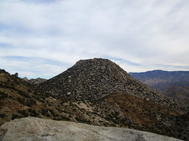
Image

Image

Image

Image
Square Top

Image
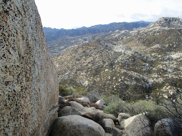
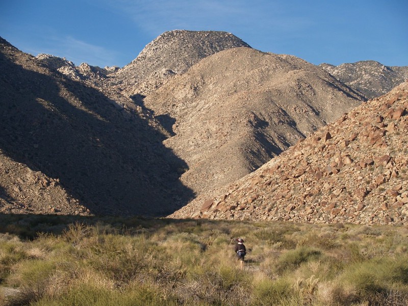
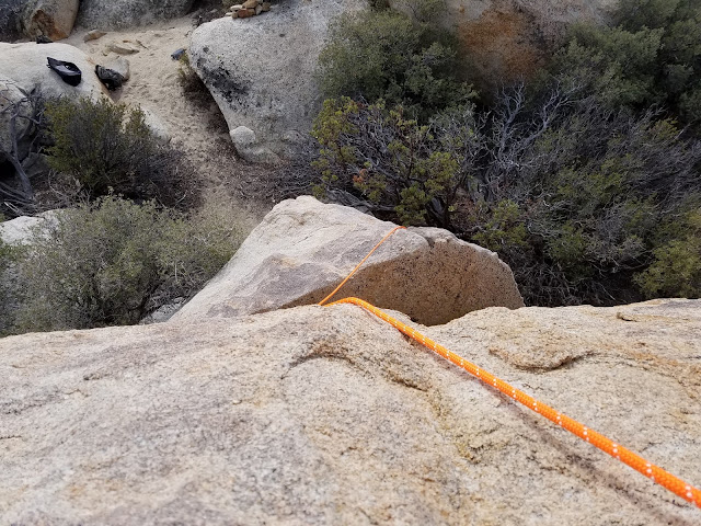
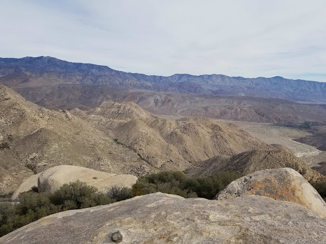
Looking down near the top of the south slope

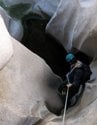
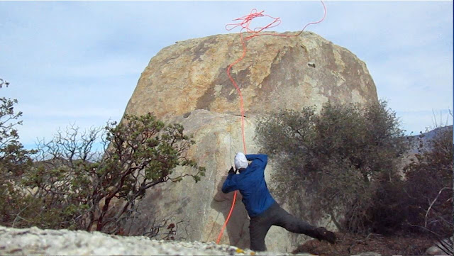
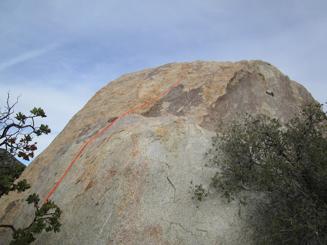
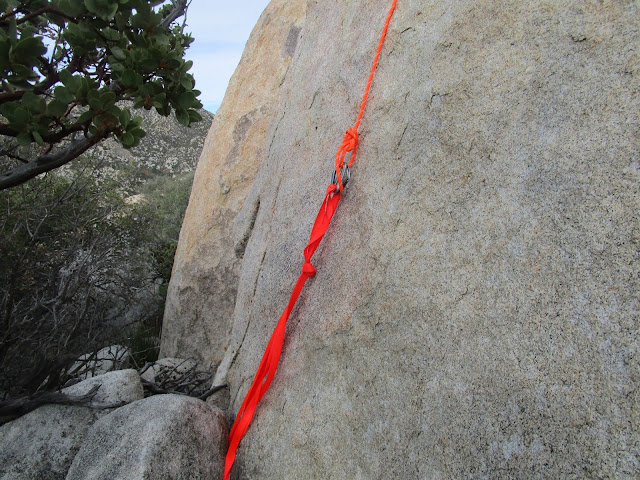
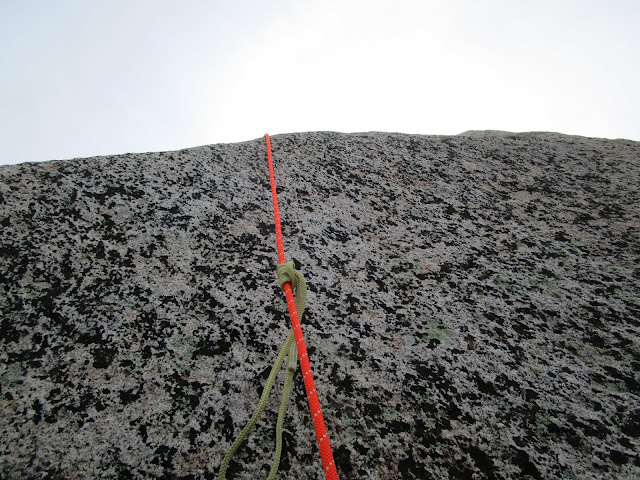
Once I got to the top, I unpacked the rope and gear, then walked around the summit block to figure out the best direction to make my attempt. The west side looked like the easiest (as other reports had mentioned) so I started hunting for an anchor on the other side. I wrapped 1" nylon webbing under a boulder and evened it out in a basket hitch. Next, I attached the rope to the anchor with a double figure 8 and two opposite facing carabiners. The next step was to throw the rope over the summit block. This turned out to be my biggest problem. My first throw went over the wrong edge and I couldn't position it correctly. My next nine plus throws, I lost count, were whipped off the north side by a strong and steady 25mph wind. The wind gusted up to 40mph and it created havoc with my throws. I tried to compensate by throwing the rope south without luck. I thought seriously about giving up on the rope, but I didn't want to try an unprotected ascent with the wind howling so hard. Finally, I tied a knot to the loose end and attached three carabiners. I eventually got the rope over. The last thing to do was get my harness on and set up the two prusik knots I used to ascend. The beginning of the block is vertical with no real holds. I used the lower prusik as a foothold, and the upper as protection, alternating the load between the two to move the other one up. It was kind of an awkward ascent, but it worked and my anchor felt strong. After I got past the vertical section, I left the lower prusik behind. The rock after that was more of a class 3 friction climb and I just used the upper prusik as protection. Just over half way, a gust of wind tore my hat off and it tumbled over the side. I was too stoked to worry about it and reached the top shortly after. In all, I spent about an hour and a half on the summit.

Image

Image

Image

Image

Image

Image

Image
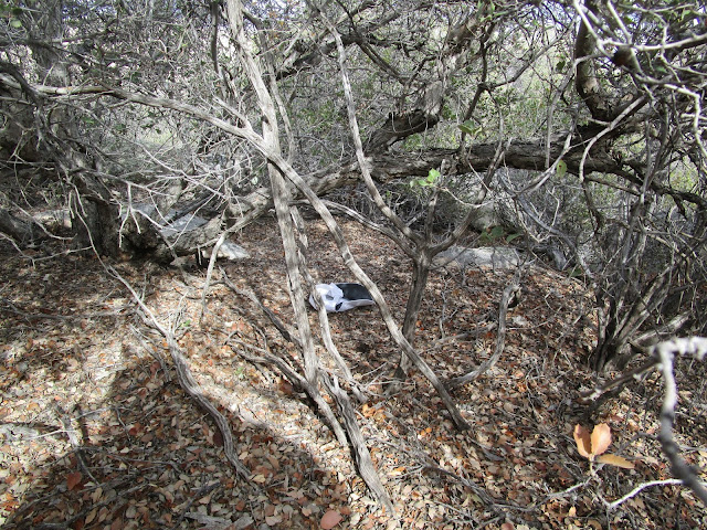
Final resting place of my hat

Image
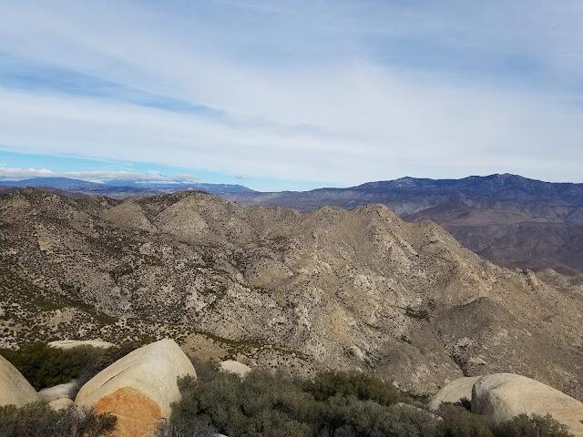
Collins Valley and assorted benchmarks

Image
Collins benchmark, a tough SDC peak for a future hike

Image
Random pinnacles in the area

Back on the ground, I hunted down my hat and checked out the register. The register was in a pair of yellow cans, a variation on the normal red. There were two small registers inside, the oldest one going back to 1991. Heading down Square Top, I had the same imbalance issues with my rope bag. Maybe I'll try bringing a large pack that I can stuff all the gear into next time. Getting the class 5 block and handling every aspect of the rope system was a first for me. It was a great starter peak for rope practice. If you are interested, I have a few 360 photospheres on my blog.
User avatar
jfr
Posts: 150
Joined: Sat Dec 12, 2009 3:01 pm

Post by jfr »

Nice hike and TR!

I've only seen Square Top from the Collins Valley side, and it's quite impressive from there. It's shape is very recognizable.

Image
Square Top and Sheep Canyon on the far left, from Coyote Canyon Road as it drops down into the Collins Valley


Image
Square Top from closer to the mouth of Sheep Canyon (that's the south fork)
My hiking trip reports: https://hikingtales.com/
User avatar
tekewin
Posts: 1194
Joined: Thu Apr 11, 2013 5:07 pm

Post by tekewin »

Great photos from the valley! Looks like you guys were doing some camping out there. Did you hit any of the local peaks?
User avatar
Girl Hiker
Posts: 1318
Joined: Fri Apr 04, 2014 7:46 am

Post by Girl Hiker »

Nice Tr, but I already told you that :)
User avatar
jfr
Posts: 150
Joined: Sat Dec 12, 2009 3:01 pm

Post by jfr »

tekewin wrote: Great photos from the valley! Looks like you guys were doing some camping out there. Did you hit any of the local peaks?
No peaks. We're way too wimpy to do that much climbing! :)

Our goal was to do some Winter backpacking without the Winter, and the desert is perfect for that. Our main objective for these hikes was to explore the canyons in the area, especially since all of them have water year-round. They are great backpacking destinations. Both Sheep and Cougar Canyons have waterfalls, so that makes for some excellent scenery, and the rocks are all big granite boulders, which makes for fun scrambling.

If you have a high clearance or 4WD vehicle you can drive all the way to Sheep Canyon. Sadly, I don't have one, so I can only drive down Coyote Canyon Road as far as I dare to take my car. We park and hike into Collins Valley from there. Sheep Canyon has a $10/night primitive campground, but I would recommend parking near there and backpacking the last half mile to the mouth of Cougar Canyon and camping in a more remote location. Complete with a beautiful view of Toro Peak.

You can check out my TR's for Anza-Borrego here

As for peaks and benchmarks in the Collins Valley area, check out peak-bagger Eric Su's "Peaks For Freaks" blog post
My hiking trip reports: https://hikingtales.com/
User avatar
tekewin
Posts: 1194
Joined: Thu Apr 11, 2013 5:07 pm

Post by tekewin »

Girlhiker70,

Thanks for the comments on FB. :)

Jfr,

Thanks for the info. You have some excellent photos and reports of the area. I love the desert so there is a lot of good reading there for me. It's nice to know you can drive right up to Sheep Canyon. I should be able to make it in a 4Runner. I am familiar with Eric Su's blog. I usually read his reports if he has already hiked a peak I am planning.
User avatar
Uncle Rico
Posts: 1394
Joined: Thu Mar 20, 2008 7:48 pm

Post by Uncle Rico »

Nice TR teke. That's some fine country that I haven't spent any time in. My list just keeps getting longer.
User avatar
AW~
Posts: 2038
Joined: Mon Oct 01, 2007 12:00 pm

Post by AW~ »

random pinnacles....you know I like them.
Not a good use of a static rope as rigged!
There are much better working hitches than the prusik.

Im trying to think if we have any summits like that in the San Gabriels...there are a few I guess. Either way that rope needs to be put to use.
User avatar
tekewin
Posts: 1194
Joined: Thu Apr 11, 2013 5:07 pm

Post by tekewin »

AW,

I bought a static rope (my only rope so far) mostly for canyon rappels, not really for this peak. I will need a dynamic rope for at least one sport climb I want to do.

I would be glad to hear any critiques or suggestions about any part of the system. I have a lot to learn.

I think Pacifico has a class 4 summit block about this size where the same technique can be used. I haven't been there yet.
Post Reply