Pacific Crest Trail (Cajon - Little Jimmy - Soledad)
I decided to head up BP via the main use trail (or whatever wasn't covered in snow) after a 6 month break from hiking because of an injury back in May. Basically it was time to get off my butt and get back to doing what I love. Got an 7:30ish start and was fortunate to meet a couple of great guys in the parking lot who invited me to hike with them - thanks Steve and Darren. The trail was clear past the first mile point and no real coverage until about the 1 1/2 point, ~7400ft. The trail was easy to follow but was icy for ever increasing stretches as we made our way up. The ice made for some slipping around at times but was manageable without crampons. The 2 mile or there abouts the trail became impossible at times to follow due to coverage so it was pretty much straight up from there. Alternating between kicking steps and following previously laid tracks the going was good and physically satisfying. Still no crampons necessary, IMO, just my ice axe. We topped out at around 10:30am to a snow free summit. The weather couldn't have been better, cool and a slight breeze. After relaxing, snacking, and re-hydrating for a half hour or so we headed down. We down-climbed the upper section until the trail became visible. The icy sections on the descent were interesting to say the least and crampons/micro spikes would have made the going safer and less nerve racking with all the slipping around I did (I'm a bit clumsy when traction gets iffy). All in all a fun hike and in spite of a cramp in my leg coming down (which was relieved by downing some electrolytes in my water and stretching) it was trouble-free.
Good review.
I tried it today with my wife - Sunday. This after turning back on Thanksgiving due to ice, etc within the initial stretch of the hike and deciding to just go elsewhere for the day. We figured with good sun and no rain lots would have melted by then... famous last words... This was only our third time in high country of the Angeles forest since we're new to the area and only second attempt at Baden-Powell...
With storm coming in tomorrow we knew this was our last chance for the year til early summer or so.
We had a good time, but only made it about halfway up where the ice/snow coverage really started to pick up. We could still manage the trail, but my wife who is not as into the outdoors as I began to slip and even fall once. Realizing we didn't have spikes and our pace was starting to slow down, the safest thing to do was simply turn around. Course, down was even slower going, but in the end it was a good time nonetheless breathing the high country air and ran into some other hikers, some of which were getting a start as late as 1/2 past noon today !!!! Glad we did the safe thing, no death marches here... we'll summit it once the ice is gone come summer.
I remember doing this hike in the sumer and the first part was steep with some exposure then later on the trails was easy to follow as it was cut through the trees. The top was a little more open and merandering. In the winter I imagine the top wouldbe best going straight up. What is the general conditions for this trail in the winter what gear is needed, is the top even doable, it get pretty narrow?
thanks,
thanks,
In the winter, as the snow gets deeper, the trail gets harder to follow down lower on the mountain necessitating the straight up ascent further down. When the snow is fresh snowshoes are the preferred mode of travel and this is a really fun way to climb this mountain. As the snow thaws and freeze the trail/route gets pretty icy so crampons and an ice axe is the safest way to travel. The ridge at the top does get a bit interesting in the winter but unless you have issues with moderate exposure (I, for some reason, don't) then one would just need a bit more care with their footwork to negotiate this section.

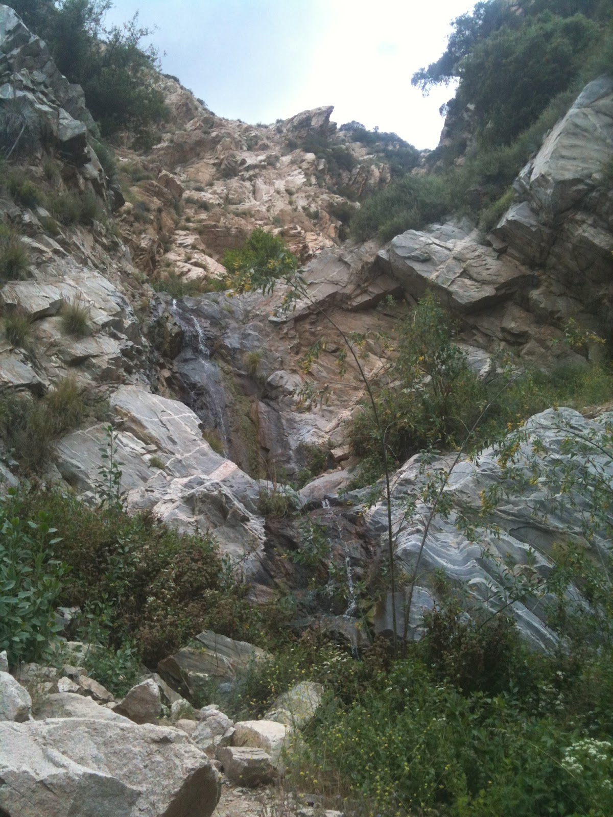
I was thinking about an overnight backpacking trip to the Little Jimmy Trail Camp this weekend and I was wondering how much snow to expect up there. I spoke with USFS and they do not have any accurate info since they stated that no one had been up there recently. I'm thinking that I will encounter no more than about a foot of the white. I was up there on Christmas day and really regretted not having snowshoes; I ended up post-holing most of the trip up there and ended up running out of daylight. Any info on the area around Islip Saddle and Mount Islip would be appreciated.
-
VermillionPearlGirl
- Posts: 239
- Joined: Wed Apr 06, 2011 9:57 am
We were at Islip Saddle and Mount Islip on Sunday (came at it from Crystal Lake). This was before the most recent rain yesterday and it's going to rain again this tomorrow evidently. But on Sunday it was practically dry up there. There was barely any snow on the trail at all.
It was funny because we went there to hike Mount Hawkins and South Mount Hawkins -- I figured it was south facing it wouldn't have snow -- but those were totally covered! But the trail up to Windy Gap was clear. When we got to Windy Gap every peak we could see but Hawkins was clear. So we ended up going to Islip instead (didn't have proper footwear for snow).
Again, this'll probably be moot by this weekend since it will have snowed between now and then!
Thanks for the info. I wonder how clear the north side of those slopes are since I will be making my approach using PCT from Islip Saddle; I know the north slopes always get more of the white then the south slopes. Based on what you reported I would imagine the worst that I may encounter would be patchy snow and/or icy sections.
I went up there for a quick overnight during the first of these weak storms. Many many patches of ice and snow along the trail, without traction my lady and I slipped a healthy amount of times, especially on the way out when the fresh snow covered the ice. Take traction if approaching from Islip saddle
I'll try to post up pics a little later
I'll try to post up pics a little later
Sounds like I may be able to get by only using micro-spikes. Since the weather service is saying that 2 - 4 inches of new snow accumulation is possible in that area I am wondering if I might need to use my crampons and ice axe instead of only using the micro-spikes.
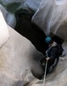
Lets see if I can do this..
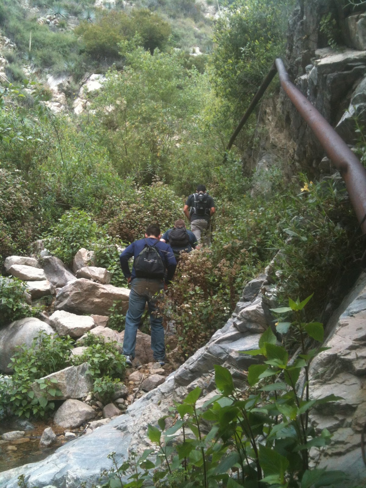
On the way in..
Its time to get out of here!
Can kind of see the other side of the trail with the boot steps along the side, its all ice and fun to hang on to..
Same place as the first picture, just 50 yards up from that picture.
For good measure
I'm sure its way worse but more powder covering the ice up there by now. Definately take traction
Thanks for posting those photos. It really helped me visualize what the conditions up there are like. This will be my second attempt to make it to this trail camp in the winter. The first attempt the snow started to get rather deep; snoeshoes would have saved that day. It looks like I should be able to make it up there on Saturday with no snoeshoes to speak of since the snow should be no deeper then a foot or so.
When I was up there last weekend they had the 2 opened completely but you will have to carry chains. I'm not sure what it's like this weekend, but I would imagine that some of the snow has melted during the past week. The only real snow and ice that I encountered was on the trail itself. Traction is needed. I saw a group of Boy Scouts slipping their way down that trail on the Saturday that I headed up. Those poor scouts had on jeans, t-shits and sneakers on that trail; I thought that they were insane not even having micro-spikes or at the very least an ice ax. That section of PCT can be treacherous when the snow and ice are present. And if you are planning an overnight trip, last Saturday night at 10PM I registered 18F on the thermometer on my watch and it did not get above freezing the rest of the time I was there. I left on Sunday at 2PM and the temp was still only 29F.
Sorry, no Spot to be found today. Man, that lower trail is icy coming and going! I hit up Throop, Hawkins, Middle Hawkins and Islip today. Had the place to myself until about noon when I SWEAR the entire Asian race descended onto the trail! I met at least 35 kind overly dressed folks between Windy Gap and Islip!
Crappy air quality, so I focused on the burnt and dead trees....NOT a cute place. I wore crampons the first hour to Windy Gap then ditched them for softer snow. Was in snow maybe 10% of the time, this is NOT February!
Crappy air quality, so I focused on the burnt and dead trees....NOT a cute place. I wore crampons the first hour to Windy Gap then ditched them for softer snow. Was in snow maybe 10% of the time, this is NOT February!


I went up Islip yesterday, and there were a few patches of really sketchy icy snow on the north slopes but otherwise 50% slushy coverage. Any flat ground up there seemed fine and most of the trail down to the spring was clear, so I bet the campground is lovely.
I didn't know this, but the PCT has a new detour for the Frog Closure section of the PCT (from Eagle's Roost to Cooper Canyon). Before the new detour, hikers simply walked along Angeles Crest Highway to Buckhorn and then took the Burkhart Trail down to Cooper Canyon to rejoin the PCT. Now, with the new detour, PCT hikers are asked to take the South Fork Trail down from Islip Saddle, then west to Devil's Punchbowl, and then from Devil's Punchbowls take the Burkhart Trail up over Burkhart Saddle and then down to Cooper Canyon. That's quite a detour. Personally, I might just ascend Mt. Williamson and then XC along Pleasant View Ridge to Burkhart Saddle rather than descend all the way to Devil's Punchbowl.
HJ
List of all PCT detours and closures
HJ
List of all PCT detours and closures
There's still one Station Fire related PCT detour in effect. Basically it's from Pacifico Mtn west down to Mill Creek Summit.
HJ
List of all PCT detours and closures
HJ
List of all PCT detours and closures

I recently noticed that too. Not sure I'd like the 18 mile detour (according to one site I won't bother to remember). That adds at least one day to your PCT itinerary I'd think. Taking HJ's cross country route would cut that out but would certainly require significant local knowledge.
Good thing I am a dayhiking peak bagger!
Good thing I am a dayhiking peak bagger!
Same ones that are now on the endangered species list after that (frivolous) lawsuit against the Forest Service for not doing enough to protect the frogs from humans....so now up and down the state, the forestry dollars get directed towards restricting public access.
In the Los Padres, they just closed Romero Camuesa Road to motorized vehicles until next year...thats a major road into the forest.
http://mapper.acme.com/?ll=34.49637,-119.54172&z=14&t=T
Road closure : "Divide Peak turnoff"
http://www.fs.usda.gov/detail/lpnf/home ... RDB5385578
http://mapper.acme.com/?ll=34.51398,-11 ... ecito%20CA
Hehehe, I just saw Hikeup's email yesterday. I'll be sending Paul an email because I do want to get back in there and help out. Recent pics show the invasive plants have overtaken the canyon so Im curious as to how it is back there.