Saturday Morning In Dark Canyon

TRs for the San Gabriel Mountains.
Post Reply
User avatar
Sean
Posts: 3748
Joined: Wed Jul 27, 2011 12:32 pm

Post by Sean »

Shawn Sites organizes trips for the Saturday Morning Hikers group on Meetup. She noticed that some of us have been working on trails in Dark Canyon, and she wanted to take her group through there. So on Saturday I guided twenty-five of them.

We set up a car shuttle along the ACH between Angeles Crest Fire Station and CCC Ridge. The group stretches together before each hike. We warmed up our leg muscles and by 8am took off down the CCC Ridge fire road to the trailhead for the Dark Canyon Road.

IMG_20181110_080823756.jpg

(Overgrown Dark Canyon Road on left next to the clear CCC Ridge road.)

IMG_20181110_082210824.jpg

(The group hikes down the Dark Canyon Road.)

IMG_20181110_085202479_HDR.jpg

(Some deadfall on the abandoned road.)

The road has received some attention lately. It's now a fairly pleasant trip down to the streambed, with the buckwheat only lightly brushing the lower body, primarily along the east side of the ridge. Once the road switches to the west side, the issues are minor rock slides, washouts, and some yucca that's easy to avoid. But the track is well-defined.

The group kept a good pace. We slowed down a little along the stream, due to deadfall and stops at a couple cabin sites.

IMG_20181110_092233027.jpg


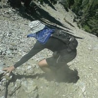
Paul Ayers had asked me to look for some unfound cabin sites in Dark Canyon, and I located one with a big wall still standing.

IMG_20181110_093231712_HDR.jpg


After reaching the confluence with the Arroyo Seco, the group wanted to stop for a break. I introduced them to the Oakwilde picnic area. They have a snack ritual involving a table cloth displaying different snacks that each hiker brought to share. I filled up on various pieces of fruit and some pretzels. Someone brought a dessert and candles to celebrate Shawn's birthday.

IMG_20181110_101731080.jpg


With satisfied bellies we all marched down the Arroyo to Paul Little Picnic Area. En route we encountered Jim Lesh, volunteer Forest Service patroller, atop his magnificent horse, Tia.

IMG_20181110_110530533.jpg


I tried to empathize with his horse, who had to stand still while twenty-five humans slowly passed by on the trail. But Tia had quite the poker face, giving away nothing about the contents of her mind.

IMG_20181110_110637585.jpg


IMG_20181110_111318746.jpg


A few yards beyond the Paul Little sign we picked up the Station Ridge Trail, a rough, steep escape path which spit us out at the Fire Station where we had left cars earlier.

IMG_20181110_111751781.jpg


IMG_20181110_113452052.jpg


Considering how many people took part in this hike, I was impressed that we all finished in good time, around four hours total.
User avatar
dima
Posts: 1319
Joined: Wed Feb 12, 2014 1:35 am

Post by dima »

Fun. None of these new (once again) trails are on osm yet. Should they be? If you want, you can point me to gps tracks, and I'll add them.
User avatar
Sean
Posts: 3748
Joined: Wed Jul 27, 2011 12:32 pm

Post by Sean »

dima wrote: Fun. None of these new (once again) trails are on osm yet. Should they be? If you want, you can point me to gps tracks, and I'll add them.
I have old tracks. I'll work on getting you a current one. Station Ridge especially has been improved with some switchbacks since my last recording.
User avatar
robow8
Posts: 43
Joined: Wed Oct 12, 2016 4:14 pm

Post by robow8 »

Is there anywhere to camp at Oakwilde? I may be doing the Gabrielino next spring.
User avatar
Sean
Posts: 3748
Joined: Wed Jul 27, 2011 12:32 pm

Post by Sean »

robow8 wrote: Is there anywhere to camp at Oakwilde? I may be doing the Gabrielino next spring.
Yeah, there is some space for a tent next to a half-buried picnic table.
User avatar
walker
Posts: 248
Joined: Mon Apr 08, 2013 11:14 pm

Post by walker »

After a hike like that, now it's an official route! (Thanks to Bill for continually working on the road and Dark Canyon.)

I visited Station Ridge last week for the first time in months and was pleased that it was in pretty good shape. It could use a little attention in a few spots, but so far seems to be holding up well.

It's a good thing that the poison oak is dormant tough, it's still pretty abundant right above the cabin site.
User avatar
harris5
Posts: 2
Joined: Sat Feb 06, 2021 6:11 am

Post by harris5 »

Thanks for this trip report. I hiked down the CCC Ridge trail last night to the upper cabin in Dark Canyon. The trail got faint beyond that, and it was too dark to poke around much so I went back up. Is the trail readily passable all the way to Oakwilde, or is it a bushwack for the last half mile?
User avatar
Sean
Posts: 3748
Joined: Wed Jul 27, 2011 12:32 pm

Post by Sean »

harris5 wrote: Thanks for this trip report. I hiked down the CCC Ridge trail last night to the upper cabin in Dark Canyon. The trail got faint beyond that, and it was too dark to poke around much so I went back up. Is the trail readily passable all the way to Oakwilde, or is it a bushwack for the last half mile?
I haven't been down there in over a year. I know a couple guys were trying to improve the route but I'm not sure how far they got. I assume it's still a bit of a scramble in sections with fallen trees blocking the path and probably debris that has washed down the canyon from recent storms. The route needs a team of sawyers to really clear it up.
User avatar
harris5
Posts: 2
Joined: Sat Feb 06, 2021 6:11 am

Post by harris5 »

Thanks for the beta. Dave Baumgartner had told me the trail was completely obliterated last time he was there, so I was pleasantly surprised how good it was. Most of it was suitable for trail running until I got down to the canyon floor. Some parts were downright groomed.

Below the cabin, I came to a narrow spot where it looked like I would have to climb through trees and bushes over the creek. It was dark so perhaps I missed a better way.

If there's any news of further trail work, I'd love to hear about it. If it's clear enough for average hikers, I'll put it in the next edition of Afoot and Afield Los Angeles County...

David
Post Reply